The map above, stitched together from 1890s 15 minute quadrangles, is intended to show the relative location of stops on the ND&C/MTA Beacon Line west of Hopewell Junction. For the immediate Beacon area, the map below, stitched together from 1947 Army Map Service 7.5 minute quadrangles, might be more helpful:
The railroad history of the MTA Beacon Line west of Hopewell Junction is complicated, and the best place I know to go to get an understanding of it is Penney Vanderbilt and KC Jones's All About Railroads Blog. To summarize: the tracks between Hopewell Junction and Dutchess Junction were built by the Dutchess and Columbia. Later, the NY&NE aquired trackage rights between Hopewell Junction and Wicopee Junction and built its own connector to Fishkill Landing on the north side of Fishkill Creek. Eventually the New Haven got control of all of these lines and the original D&C connection to Dutchess Junction was abandoned, NY&NE tracks east of Hopewell Junction were combined with the route to Poughkeepsie, and the Central New England operated the route to Fishkill Landing as a vassal of the New Haven. I have arbitrarily decided that the NY&NE route from Fishkill Landing to Providence is the most pure essence of the "Hartford Providence and Fishkill" that I set out to explore, so that's what I will list as the "mainline." The D&C to Dutchess Junction never was under NY&NE control, but seems related enough that it deserves a mention here as a spur.
As always, the photos here begin with railroad ephemera like tickets and timetables, then photos of any trains I rode to explore the area, and finally photos proceeding from Providence to the Hudson. Since the waters of the Hudson lap up against Fishkill Landing, this is the very last page on the site.
Click on the thumbnail for the full resolution image
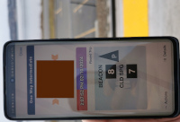 |
An
adult ticket on the Metro North Hudson Line from Beacon south to Cold
Spring. The QR code is defaced. My family and I rode this train to get
a look at the tracks remaining at the Fishkill Landing site (and enjoy
the beauty of the water level route) (2/2024.) |
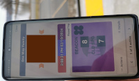 |
A family fare, allowing a child
to ride with a parent on Metro North trains for a nominal fee. This
image, also defaced, was one of my kids' tickets on our Hudson Line
excursion (2/2024.) |
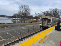 |
Shoreliner Coach 6309 led our Hudson Line train that we took to explore the site at Fishkill Landing. It was built in 1991 (2/2024.) |
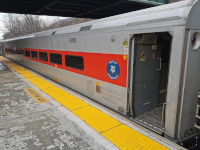 |
Shoreliner coach 6262 "Wilton" was our ride from Beacon. It was built in 1983 (2/2024.) |
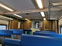 |
The interior of Shoreliner coach 6262 "Wilton" (2/2024.) |
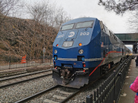 |
Metro North 202, a P32AC-DM built in 1995,
was our motive power at the back of the train. It is shown here at Cold
Spring. The same locomotive appears in some of our shots at Danbury (2/2024.) |
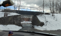 |
The entrance to Madam Brett park
in Beacon, with a bridge carrying the Beacon line over the driveway.
This is the first place we've visited the line west of Wicopee Junction
(2/2024.) |
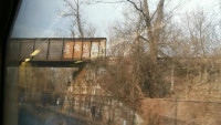 |
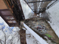
A look at the Beacon Line crossing over the Hudson Line, from a northbound Hudson Line train.
This is looking north at the eastern bridge abutment. The NY&NE
approached from the right (from Hartford,) crossed this bridge, and
then curved north to parallel the Hudson line. The details of our
northbound Hudson line locomotive are on the Dutchess Junction page to
avoid redundancy (2/2024.) |
 |
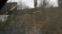
On foot, looking south at the same bridge abutment (the eastern one) as in the photo above (2/2024.) |
 |
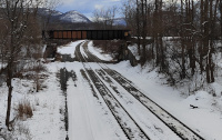
Looking south at the western
Beacon Line crossover abutment, from the southbound train detailed
above. Trains from Hartford would be coming from the left (2/2024.) |
 |
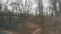
A look southbound at the entire
crossover bridge that carries the Beacon Line over the Hudson Line.
Trains from Hartford would come from the left and curve right,
eventually running north and parallel to the Hudson Line. This shot was
taken from the road access bridge to Dennings Point (2/2024.) |
 |
The road access bridge to Dennings Point from the southbound Hudson Line train detailed above (2/2024.) |
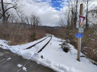 |
Looking south (railroad east) towards Hartford and Providence at the Denning's Point Crossing (2/2024.) |
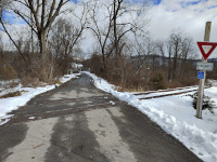 |
A view of the tracks on the
Denning's Point crossing. The bridge over the Hudson Line is visible in
the distance, which is looking east (2/2024.) |
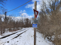 |
Looking north (railroad west) from the Denning's Point crossing, towards Fishkill Landing (2/2024.) |
 |
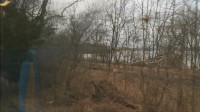
The NY&NE tracks were built right along the Hudson and were in some places built on trestles and fill.
This is why the MTA Beacon Line between Denning's Point and Fishkill
Landing is much closer to the river than the Hudson Line, from which
this shot was taken (2/2024.) |
 |
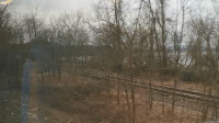
A bit further north and the
switches required to link the Beacon Line to the Hudson Line but also
serve Fishkill Landing begin to appear. Taken from a southbound Hudson Line train (2/2024.) |
 |
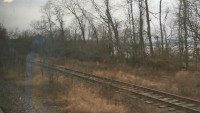
The far track will continue
along the Beacon Line's present course, the nearer one will join the
Hudson Line. At Fishkill Landing, some NY&NE tracks joined the
Hudson line and in later years a common station with the NYC was used.
Some other tracks curved onto the ferry landing, and still others continued parallel to
the Hudson before terminating. The far track is long abandoned and from the
1936 Dutchess County Aerial Photos seems to have been one of the latter. The near track is the link
between the MTA Hudson and Beacon Lines. Taken from a southbound Hudson Line train (2/2024.) |
 |
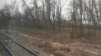
The
difference in maintainance
is obvious for the two tracks. The near track is about to join the
Hudson line (from which the shot is taken) and is in decent condition.
The far track, which terminates at the Long Dock Road overpass, is
overgrown enough to be unusable.Taken from a southbound Hudson Line train (2/2024.) |
 |
The
location of the switch, labeled RIVER, joining the MTA Beacon Line to
the MTA Hudson Line. Taken from a southbound Hudson Line train (2/2024.) |
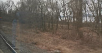 |
The Beacon Line track merging with the Hudson Line. This allowed Beacon Line trains (last passenger service provided by the Central New England Railway when it was a subsidiary of the New Haven) to use the common station with the NYC. Taken from a southbound Hudson Line train (2/2024.) |
 |
A shot from a trail attached to
Scenic Hudson's Long Dock Park. The abandoned track to the yard between
Fishkill Landing and the MTA/NYC Beacon Station is between us and a
northbound Metro North train of Shoreliner coaches on the Hudson Line
pulled by P32AC-DM locomotve 221 (built 7/2001) (2/2024.) |
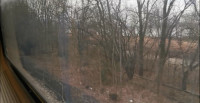 |
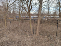
The surviving track that served the Fishkill Landing Area west of the Hudson line is extremely overgrown (2/2024.) |
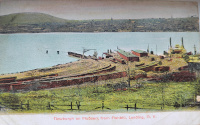 |
A postcard, postmarked in 1908, showing the ferry landing at Fishkill Landing. |
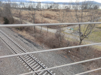 |
A similar vantage point in 2024,
taken from the Long Dock Road overpass. The paved path running
perpendicular to the tracks at center leads to where the ferry is
parked in the above vintage postcard. Note also the end of the out of
service tracks we've been following. It's not clear where these once
terminated; the overpass I'm standing on to take this shot has an
abutment that blocks their right of way (2/2024.) |
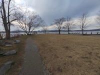 |
Looking
out at Fishkill Landing, now part of Scenic Hudson's Long Dock Park.
The ferry would have parked on the right hand side (2/2024.) |
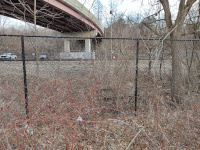 |
The view of the Hudson Line and
abandoned tracks below the Long Dock Road overpass. Note that the
abandoned tracks end here (2/2024.) |
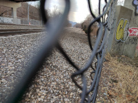 |
Looking south along the Hudson
Line tracks. The modern abutment on the Long Dock Road overpass in the
foreground blocks the vintage abandoned track from continuing (2/2024.) |
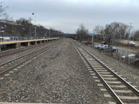 |
Looking south from the modern MTA Beacon island platform. The Long Dock Road overpass is in the foreground (2/2024.) |
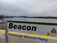 |
A platform sign at the modern MTA Beacon Station. There was once a combined NYC/Central New England station here to serve both the Hudson and Beacon Lines (2/2024.) |
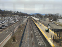 |
A view of the modern Beacon Station from its footbridge. Fishkill Landing is visible in the far distance (2/2024.) |
Return to Hartford, Providence, and Fishkill Railway Index
(c) 2016-2024 Timothy M Dowd. Last Modified @ 21:19 EDT on 2024-02-21
Made with KompoZer v0.8b3 (20081229)