The map above, stitched together from 1890s 15 minute quadrangles, is intended to show the relative location of stops on the ND&C/MTA Beacon Line west of Hopewell Junction. For the immediate Beacon area, the map below, stitched together from 1947 Army Map Service 7.5 minute quadrangles, might be more helpful:
The railroad history of the MTA Beacon Line west of Hopewell Junction is complicated, and the best place I know to go to get an understanding of it is Penney Vanderbilt and KC Jones's All About Railroads Blog. To summarize: the tracks between Hopewell Junction and Dutchess Junction were built by the Dutchess and Columbia. Later, the NY&NE aquired trackage rights from the line (now called the Newburgh, Dutchess, and Connecticut, or ND&C) between Hopewell Junction and Wicopee Junction and built its own connector to Fishkill Landing on the north side of Fishkill Creek. Eventually the New Haven got control of all of these lines and the original D&C connection to Dutchess Junction was abandoned, NY&NE tracks east of Hopewell Junction were combined with the route to Poughkeepsie, and the Central New England operated the route to Fishkill Landing as a vassal of the New Haven. I have arbitrarily decided that the NY&NE route from Fishkill Landing to Providence is the most pure essence of the "Hartford Providence and Fishkill" that I set out to explore, so that's what I will list as the "mainline." The D&C to Dutchess Junction never was under NY&NE control, but seems related enough that it deserves a mention here as a spur.
Wicopee Junction is where the NY&NE built its own connection from the ND&C track to Dutchess Junction. Once both lines were under the control of the Central New England (owned by the New Haven,) the branch to Dutchess Junction was abandoned in 1916. The rest of the ND&C west of Hopewell Jct and the NY&NE track to Fishkill Landing has survived until 2024 as the Metro North Beacon Line, but the MTA has formally been given permission to start abandoning the line. A 1932 photo on the All about Railroads blog looks very similar to the photos below, but Wicopee Junction might soon look very different.
Click on the thumbnail for the full resolution image
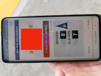 |
A
defaced view of my ticket to ride from Cold Spring to Beacon on the
Hudson Line. The photos on this page of the Dutchess Junction Station
Site were taken from that train (2/2024.) |
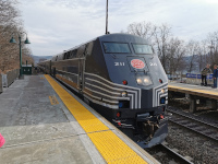 |
Metro North P32AC-DM locomotive 211,
seen here at Cold Spring, pulled us through Dutchess Junction as it can
be seen from the Hudson Line. Note that it is in New York Central
livery- this is a heritage scheme done to celebrate Metro North's 40th
anniversary. Locomotive 208 in a different heritage scheme (the
original Metro North one) can be seen on the Danbury section of this page (2/2024.) |
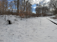 |
Standing at Wicopee Junction
next to the remaining NY&NE track to Fishkill Landing. The D&C
right of way to Dutchess Junction is straight ahead, as are the
abutments of the Tioronda Bridge (2/2024.) |
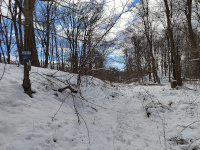 |
Entering the limits of Madam
Brett Park along the D&C Mainline. The POSTED sign seemed to allow
non-motorized activities, so I pressed on (2/2024.) |
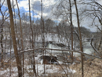 |
Looking west and down into Fishkill Creek at the site of the Tioronda Bridge. The abutments are visible (2/2024.) |
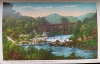 |
An undated vintage postcard, looking at the former D&C Tioronda bridge over Fishkill Creek. |
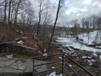 |
A similar view in 2024. The bridge would have been over the waterfall (2/2024.) |
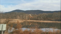 |
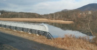
Looking across the mouth of
Fishkill Creek to what appears to be the old D&C right of way
running along the south bank. This shot is from a northbound Hudson
Line train (2/2024.) |
 |
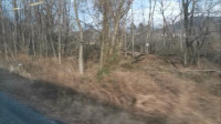
Another shot from a northbound
Hudson Line train across Fishkill Creek. What appears to be the D&C
right of way is visible under the houses in the distance (2/2024.) |
 |
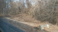
I believe this shot to be just
north of the Dutchess Junction Station, and that we're looking at the
old D&C right of way coming to meet the Hudson Line. Shot from a
northbound Hudson Line train (2/2024.) |
 |
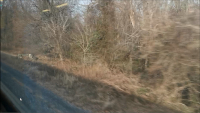
I believe that this is the site
of the Dutchess Junction station, as seen from a northbound Hudson Line
train. The concrete object in the foreground I believe is the remains
of the footbridge that can be seen in the 1936 aerial photos just south of the depot (2/2024.) |
 |
A better view of what I suspect are the footbridge remains (2/2024.) |
Return to Hartford, Providence, and Fishkill Railway Index
(c) 2016-2024 Timothy M Dowd. Last Modified @ 14:10 EST on 2024-02-28
Made with KompoZer v0.8b3 (20081229)