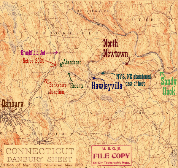
The tracks, originally from 4 separate railroads, were reconfigured extensively once the New Haven gained control. The maps below are a detail of the area discussed on this page, between Hawleyville and North Newtown:
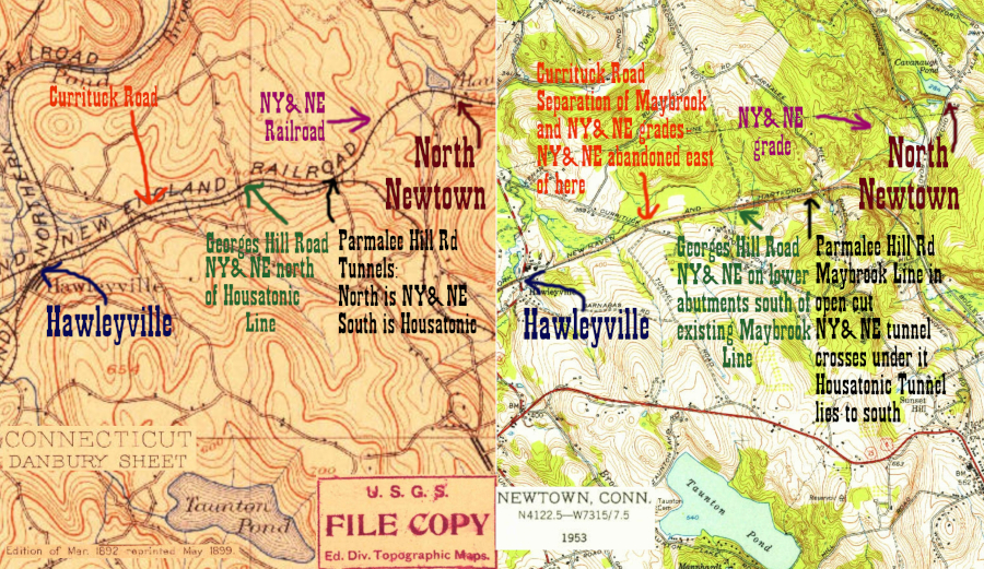
As can be seen, by 1953 the NY&NE right of way east of the tunnel at Parmalee Hill Rd was abandoned. Today, the track pattern in Hawleyville appears simple, but it had a complicated history that can best be read at Joe Brennan's site here. The extant track in Hawleyville is the Maybrook line. To construct this, the New Haven Railroad built a new cut at Parmalee Hill just above the NY&NE tunnel, so that the former brought the NY&NE roadbed under the new cut from northeast to southwest. The original Housatonic Railroad tunnel, to the south, was abandoned. The Maybrook Line is essentially the combination of the Housatonic RR (running from Derby to Hawleyville,) and the NY&NE (running from Hawleyville to Hopewell Jct) joined together in this new cut. The NY&NE east of Hawleyville became a spur. Trains would approach the NY&NE tunnel from the east, go under the Maybrook line, and then run parallel and below the Maybrook until just east of Currituck Rd. The best view of this connection while active is 1934 Connecticut Aerial Photo 03815. Both tunnels and the cut are clearly visible at Parmalee Hill Rd.
Eventually the link to Waterbury was deemed unneccesary (the Maybrook line is connected to the Metro North Waterbury Branch) and therefore the former NY&NE closed as early as 1939, according to the Larkin State Park Bridle Trail's page. 1965 CT Aerial Photo 00747 shows the abandoned trackway under the Maybrook.
As we move west, near Route 25 in Hawleyville is the stub of the former Shepaug RR, which the Housatonic Railroad uses as a lumber distribution facility. According to a map at Tyler City Station the depot was on the south side of the tracks near the Shepaug Junction. Today on the north side of the tracks there is a modern Mitchell gas station/deli with a Hawleyville station signboard inside and wallpaper that has a map of the railroad.
As on all of these pages, photos move from east to west, that is, as if you were coming from Providence.
Click on the thumbnail for the full resolution image
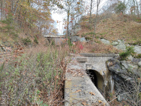 |
A
view of the west portal of the NY&NE tunnel under the Maybrook Line
(today's Housatonic RR.) This is looking east. The overpass is
that of Parmalee Hill Road, and the other side of the tunnel is on the
opposite side of the tracks past the overpass (11/2023.) |
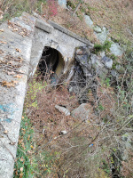 |
A
view of the western 1911 NY&NE tunnel portal and grade below the
Maybrook. According to the two resources cited at the bottom of the
page the tunnel is still passable- to date I've not had time to try this (11/2023.) |
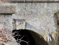 |
1911 Date on the NY&NE Tunnel in Hawleyville (11/2023.) |
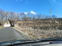 |
A
wide angle view (facing north) of the rail bridges crossing Georges
Hill Road, the next crossing west of the tunnel. Except for
the tunnel itself, there's no better clue than these abutments about
the location of the NY&NE relative to the Maybrook: we can see the
NY&NE grade in the forground gently sloping down below the extant
Maybrook track. We can also see the empty abutments in front of the
extant rail bridges that would have historically carried the slightly
lower bridge of the NY&NE. 1934 Connecticut Aerial Photo 03815 shows the missing bridge from when it was in use (3/2024.) |
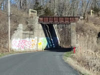 |
A closer view of the abutments
at Georges Hill Road, clearly showing the missing lower level bridge
that carried the NY&NE. This is facing north (3/2024.) |
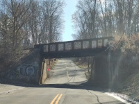 |
Looking
south at the bridge over
Currituck Road. Just east (left) of this bridge was a series of
switches where the NY&NE from Waturbury merged with the main
Maybrook Line. That means that west of this bridge, rail is still
active on the NY&NE, at least to Danbury. (Rail is active east of
this bridge to Derby, but following the old Housatonic route) (3/2024.) |
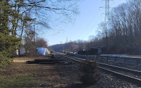 |
The start of the junction with the former Shepaug Valley Railroad, now a spur to the Housatonic RR's lumber distribution facility. This view is looking east towards Hartford (3/2024.) |
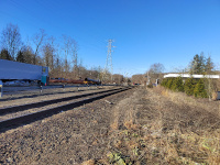 |
Looking towards Hawleyville Rd and Danbury from the north side of the tracks. The 1934 Connecticut State Aerial Survey photo 03854 shows the depot would be on the south (opposite) side of the tracks between the camera and the modern gas station canopy (3/2024.) |
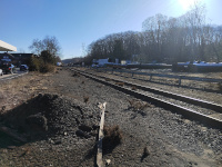 |
Looking southeastward across the tracks to the depot site from Hawleyville Rd (3/2024.) |
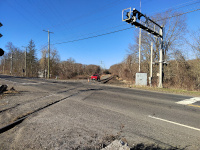 |
The crossing at Hawleyville Road, looking west towards Hobarts and Danbury (3/2024.) |
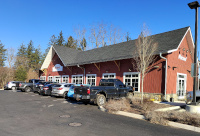 |
The modern Mitchell's Gas Station, on the north side of the tracks across from the depot site (3/2024.) |
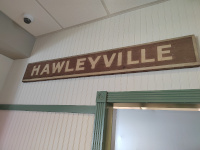 |
On display in the Mitchell's Gas Station (3/2024.) |
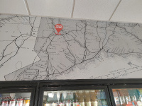 |
On display in the Mitchell's Gas Station (3/2024.) |
Joe Brennan's site about the tunnels at Hawleyville
Vizettes Railroad History Explorations
Return to Hartford, Providence, and Fishkill Railway Index
(c) 2016-2024 Timothy M Dowd. Last Modified @ 13:56 EDT on 2024-03-23
Made with KompoZer v0.8b3 (20081229)