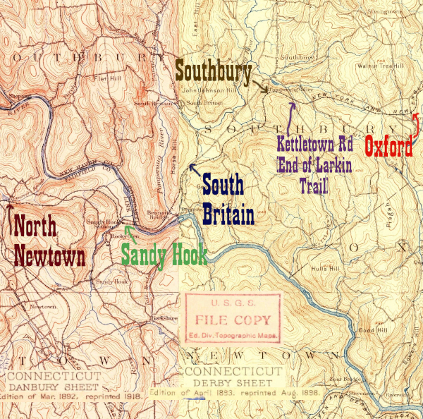
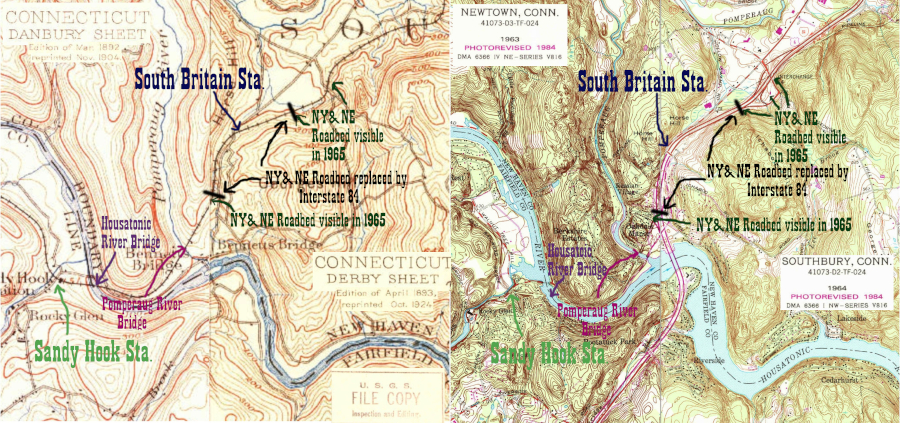
The 1913 timetable I have on the index page lists South Britain station as being 2 miles east of the Sandy Hook Station, which is just on the other side of Lake Zoar (the Housatonic River.) The builders of Interstate 84 had to squeeze a highway between the same hills the builders of the NY&NE put their railroad in, and much of the railroad right of way near the location of the South Britain station is lost to the broad right of way of the interstate. The easiest way to see this is to compare the 1934 and 1965 Connecticut State Aerial Surveys. The '34 (Image 5229) shows the railroad and the '65 (Image 3530) shows the highway. The only resource I can find for a location is the Tyler City Station site, which says it's north of I-84 at the overpass carrying Ichabod Rd. This general location matches the milage from Sandy Hook, according to a quick Google Maps measurement.
In addition to this all but lost site in Southbury, New Haven County, in 2009 the Friends of the Valley Railroad built a small station shelter in Hadlyme, Middlesex County. The station at South Britain was only a shelter, but a very unique one, and and it inspired the history-minded organization to make a second copy. It can be seen from Valley RR trains, and serves as a way to make a connection between the train and the Chester-Hadlyme Ferry.
Click on the thumbnail for the full resolution image
 |
Looking east along Main Street
S, Southbury. I-84 and its wide right of way is at right, and it has
been built over the railroad right of way in this location. See 1934 CT Aerial Survey Photo 5229 (to see the railroad) and 1965 CT Aerial Survey Photo 3530 (to see I-84 as originally built) (11/2023.) |
 |
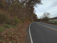
Heading west on I-84 towards the
Ichabod Road Overpass. This photo covers the highway right of way, and
the one below it covers Main St South's right of way, and according to
the Tyler City Station site, the depot would have been somewhere within either this shot or the one after it (3/2024.) |
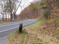 |
Looking west along Main Street S, Southbury. The overpass in the distance is over I-84, and is carrying Ichabod Rd. According to the Tyler City Station site, the South Britain stop was somewhere in this area (11/2023.) |
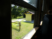 |
Hadlyme
Station on the Valley Railroad, a 2009 replica of South Britain on the
New York & New England Railroad. Image taken from Valley Railroad
Coach 503 (built by Pullman in 1914) (7/2014.) |
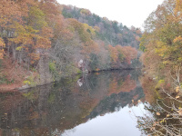 |
Abutments left over from the
Pomperaug River bridge of the New York & New England Railroad.
Taken from River Road (11/2023.) |
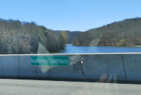 |
Looking west from the I-84
bridge over the Housatonic River. Across the water on the right
(Southbury) side we see River Road, winding around the base of the hill
between the Pomperaug and Housatonic valleys. Above it is another line:
this is the NY&NE roadbed heading towards its former bridge across
the Housatonic towards Sandy Hook and Danbury (3/2024.) |
Important Link: Discussion of Railroad History in Southbury:
https://www.iridetheharlemline.com/2010/12/03/history-of-my-hometown-the-railroad-in-southbury/
Return to Hartford, Providence, and Fishkill Railway Index
(c) 2016-2024 Timothy M Dowd. Last Modified @ 21:34 EDT on 2024-03-31
Made with KompoZer v0.8b3 (20081229)