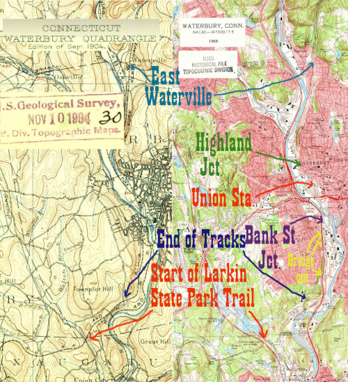
The NY&NE/ Hartford, Providence, and Fishkill approaches Waterbury from Waterville and Plymouth and joins with the line to Thomaston at around the corner of Johnson and Manhan Streets. This is known as Highland Junction, as the NY&NE in this part of the state was known as the Highland Division on the New Haven railroad.
I've been trying to use the USGS topographic maps dating from the 1890s and early 1900s to organize this website, but the 1909 construction of Union Station completely altered the area, so I've included a much later map, from 1968, as well. In the 1904 map, the two lines snake around each other, call on opposite sides of the old station to one another, and cross the river on separate bridges. For most of the 20th century and today, the two lines run together into Waterbury Union Station and its railyards, cross the river on the NY&NE bridge and then separate again near Washington Street at a place called Bank Street Junction, which was well explained in a railroad.net discussion that can be found here.
The 1968 topo map still shows the twin bridges across the river, but the original Naugatuck bridge is part of a spur serving a single factory. A look at Google Maps today shows that the NY&NE bridge is still in use for both lines, and the Naugatuck line bridge is gone except for the abutments.
A clue as to why the NY&NE bridge was picked to carry the two lines can be found in Image 7066 from the 1934 Connecticut Aerial Survey. There was a large roundhouse and another yard accessed from the NY&NE line, making the line in Waterbury important even after the abandonment of the line to the west, which Tyler City Station claims began in 1937.
Most of the NY&NE was abandoned in the late 1930s between Waterbury and Hawleyville, but a stub was left in Waterbury for a while to serve local businesses. As of 2023 that stub is disconnected and the bridges over the roads are slowly being removed. The tracks themselves are in many places still in place south of Leonard Street, running through fenced off forest (visible on Google Maps) before ending at Highland Street. The 1968 map shows this same terminus, although they go into the factory at the end of the line, whereas today they're truncated east of Highland Street.
Click on the thumbnail for the full resolution image
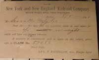 |
An August, 1890 postcard from
the NY&NE freight department to the Scovill manufacturing company
of Waterbury (famous for brass buttons.) According to the eBay seller
that sold this, it refers to an underweight shipment, which I can
almost convince myself of despite of the handwriting. |
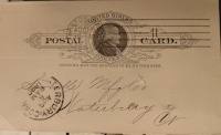 |
The opposite side of the 1890 postcard. |
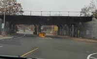 |
The
bridge over Freight Street in Waterbury, CT (November, 2023.) What
makes this bridge notable is that advertising previously protected a
large legend proclaiming "NEW HAVEN RAILROAD" which is still readable
but much less so than in the Google Street View from a few years
back. The next photo is from the same shot but zoomed in |
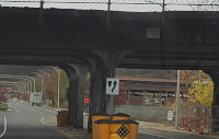 |
The bridge over Freight Street in Waterbury, CT (November, 2023.) What makes this bridge notable is that advertising previously protected a large legend proclaiming "NEW HAVEN RAILROAD" which is still readable but much less so than in the Google Street View from a few years back. This photo is from the previous shot but zoomed in |
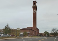 |
Waterbury Union Station in
November, 2023. The station was built in 1909 and has an enormous clock
tower, a nod to the nearby Seth Thomas plant. |
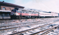 |
A view of CDOT FL9 2016 and
coaches with the southern part of Waterbury Union Station sometime
between 2000 and 2002. Note the massive number of tracks |
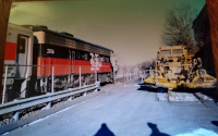 |
A view of a CDOT FL9 and coaches at Waterbury Union Station. This image dates from sometime between 2000 and 2002. |
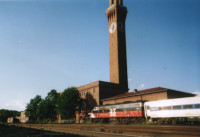 |
A view of Waterbury Union Station and its tracks with a CDOT FL9 and a coach. This image is sometime between 2000 and 2002. |
 |
Tracks south of Union Station in
Waterbury, CT (November, 2023.) This is seen from the Route 8 North
on-ramp from Riverside Street |
 |
At the former junction between
today's MTA Waterbury Branch and the former NY&NE mainline to
Danbury. This screenshot, from a video filmed as our car went from
Riverside Dr to Route 8 North in November, 2023, appears to show the
NY&NE disconnected from the main line |
 |
The MTA Metro North and former NY&NE branches separating south of Bank Street Junction in November, 2023 |
 |
The MTA Metro North and former NY&NE branches separating south of Bank Street Junction in November, 2023 |
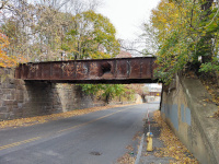 |
Looking East on Washington Ave
in November, 2023. The bridge in front is the derelict former NY&NE
mainline, note the wide abutment big enough for two tracks. In the distance is the active MTA branch to Devon and beyond. |
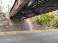 |
NY&NE bridge over Washington Ave, November 2023. Note the wide abutment and disused cable connector |
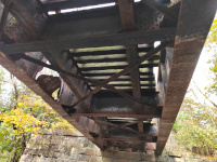 |
NY&NE bridge over Washington Ave, November 2023 |
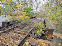 |
NY&NE bridge looking north over Washington Ave, November 2023 |
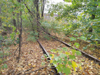 |
NY&NE bridge looking south over Washington Ave, November 2023 |
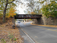 |
Looking West on Washington Ave at the old NY&NE bridge in November, 2023 |
 |
Looking at a Porter Street
Bridge abutment in November, 2023. This is the next road south of
Washington Ave to be bridged and as of November 2023, Google Street
View and satellite view still show a pair of derilict bridges here.They were gone before my first visit in 2023. |
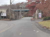 |
The empty NY&NE abutments at South Leonard St. This is looking west with Rte 8 in the background, November, 2023. |
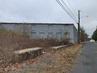 |
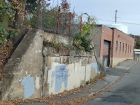
This building, on Highland
Street, is on the 1968 map at the very end of the remaining NY&NE
line. Although the tracks no longer cross Highland Street, they
amazingly still are in the woods on the opposite side. As of 2023, this
building appears to be in use. (11/2023) |
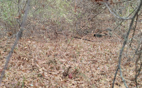 |
The end of the NY&NE line in
Waterbury, just east of Highland St. The tracks are still there, and
can be easily seen on Google Maps if you look at a winter set of photos
(11/2023) |
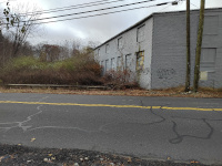 |
A look across Highland Street at
the former crossing. The tracks would have served the building directly
in front of the camera. According to Tyler City Station the tracks beyond here were abandoned beginning in 1937. |
Return to Hartford, Providence, and Fishkill Railway Index
(c) 2016-2023 Timothy M Dowd. Last Modified @ 22:33 EST on 2023-11-22
Made with KompoZer v0.8b3 (20081229)