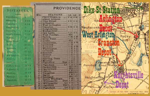
The old Hartford, Providence, and Fishkill seat check at far left calls the station stop in this area Olneyville. The New York, New Haven, and Hartford schedule in the middle calls it Arlington. Those are two adjacent neighborhoods, one in Providence (Olneyville, famous for its Hot Wieners) and one in Cranston. But they're clearly the same station, 2.5 miles from Union Station, and that puts it just after the HP&F diverged from what is today's Northeast Corridor.
To understand the railroad history of the site, I visited in multiple ways. The first set of photos will come from the trip I took on a modern MBTA Providence Line local train through the Northeast Corridor part of the junction. The next set will come from a time I walked Cranston St on foot. And finally, there will be some from a bike ride I took from River Point (MP11) east, to try and use the milage listed in the timetable above to locate station sites.
The March, 1913 timetable lists a lot of local stops along the HP&F/NY&NE/Hartford Branch. On today's Washington Secondary Trail, the depots in Coventry are well marked with signs and historical photos, but in West Warwick, Warwick, and Cranston, there's no such clues as to where you are. I was also intrigued by the fact that the Washington Secondary trail begins on Depot Ave, very close to the Northeast Corridor, but according to Edward Ozog's site the Cranston Depot was further up the line on Dyer Ave at the Cranston Print Works. I suspected that the Washington Secondary trail must begin at one of the two stations listed between Dike Street and Cranston, but I wanted to be sure.
I decided that the best way to accomplish finding the suburban station sites and confirming which depot the "depot" in Depot Ave referred to was to hop on a bike. The easternmost station I thought I knew the site of with any certainty was River Point in West Warwick, at Mile 11. I thus took my 1913 timetable and subtracted each listed miles from 11, to determine how far I'd have to ride to get to each. I downloaded an Android app called Bike Ride Tracker. Bicycle GPS by Oxagile LLC, got on my bike at Horgan Elementary in West Warwick, and was off.
There was a bug in the app so that the time continually reset, rendering my speed and health data useless, but it did a good job tracking my location. The very beginning of the Washington Secondary, at Depot Ave in Cranston, is 8.4 miles from River Point, which is exactly where the timetable predicts the Arlington Station would be. The 1972 RI state aerial photography shows this location is adjacent to the middle section of the Narragansett Brewery, today demolished.
For the fascinating history of this area to make sense, I recommend aerial photography. Please go here on Google Maps:
https://maps.app.goo.gl/umPnwu5xvEHQ2zUz8
and turn the satellite images on.
You should now be looking at the letter A. The left side of the A is the trees lining the abandoned HP&F trackway and the rail trail. The right side of the A is the extant Northeast Corridor. The cross piece of the A is Cranston Street.
On our Wickford Junction bound MBTA train, № 815, we will approach the top point of the A and continue down the right side. We will see the left side (the HP&F) veering off.
Inside the triangle made at the top of the A, the United Traction Electric Company once had a trolley barn, which became part of the Narragansett Brewery. It is the large vacant space you can see being developed in these photos. Across from it on Cranston St was the brewery proper, where the police station now is.
As always on this site, the photos go from east to west.
Click on the thumbnail for the full resolution image
| Previous Section |
Dike Street Station |
 |
A frame of a video taken from MBTA train № 815 at about milepost 182.8. We are just emerging from under Union Ave in Silver Lake, Providence, and the building is 176 Union Ave. The 1972 RI State aerial photos show the switch onto the HP&F was located at the very far corner of this building (12/2023.) |
 |
A tiny bit further than in the
previous frame. The purpose of this photo is to show the appearance of
176 Union Ave, which is hard to see in the first and 3rd photos, which
are railroad wise more important (12/2023.) |
 |
The very south edge of 176 Union
Ave is visible at far right. The tracks of the Northeast Corridor
(which we are on) are noticably curving away towards the east, whereas
the old HP&F would have followed the line of the back of the
building here.This is the top of the A shape discussed above. (12/2023.) |
 |
The next building still standing
from the 1972 aerial photos is ABC Roofing Supplies at 200 Whitehall
St. The HP&F main would be parallel to the back of this building,
and about halfway between the building and the tracks our train is on.
The building did have a rail spur off the HP&F to serve it
directly, this would have to be accessed from a Providence-bound train
on the HP&F. (12/2023.) |
 |
The abandoned trackway is in
this wooded thicket. It runs parallel to the houses along Lincoln Ave,
the first of which we can see through the trees here (12/2023.) |
 |
This is the site of the former trolley barn of the United Traction Electric Company
which later became part of the Narragansett Brewery. We are on a
Northeast Corridor train moving down the right side of the A shape
discussed above. The former HP&F is easy to spot- it is behind the
line of houses on Lincoln Ave (at right) and is in a line of trees. The
trolley barn site is the triangle surrounded by the A frame, and we can
see here in 2023 that it is being developed. The 1972 RI state aerial photos show a spur from the HP&F serving this property (12/2023.) |
 |
Another look at the trolley barn
site. This is our last look from the Northeast Corridor, which past
this point is too far east to show us much along the HP&F, which is
still parallel to the backs of the Lincoln Ave houses. Our next shot
will be from Cranston Street, looking north from where the trackway
goes under Cranston St. (12/2023) |
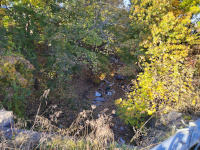 |
Looking
down and north towards the Northeast Corridor onto the disused HP&F
trackway. This is off the Cranston Street overpass in November, 2023. |
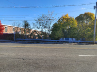 |
Looking
across Cranston Street to the south side of the overpass. The red brick
building is the Cranston Police Department, and this was once the site
of the Naragansett Brewery (11/2023.) |
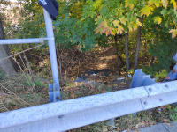 |
Looking down and south at the abandoned roadbed towards the depot. (11/2023) |
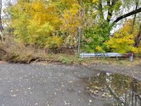 |
Looking North from Depot Ave at
the start of the Washington Secondary Trail. The guardrail marks the
very beginning of the rail trail. Beyond the guardrail lies the
abandoned roadbed seen above. This is my best guess at the site of the
Arlington station stop seen in my March, 1913 timetable. (11/2023) |
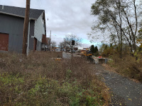 |
Looking West on Depot Ave from the Arlington Station site and the beginning of the Washington Secondary trail. (11/2023) |
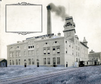 |
The Narragansett Brewery in a vintage view provided by the Providence Public Library.
I think this is looking south, and that Depot Ave comes towards the
front of the building from the right. This would be on the left side of
the photo below. Licensed under a Creative Commons Attribution-ShareAlike 4.0 International License. |
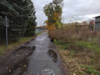 |
Looking south down the
Washington Secondary. Ahead lie 19 miles of paved rail trail to Summit,
RI, and eventually the entire 30 miles to Moosup, CT will be usable. (11/2023) |
 |
The
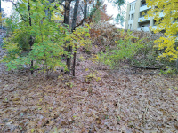
remains of a small spur or a second track behind the Harris House
Apartments. Not much rail survives along the Washington Secondary Trail
in West Warwick, Warwick, or Cranston, with the exception of spurs like
this (11/2023.) |
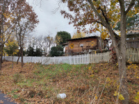 |
A nod from a neighbor about the Washington Secondary Trail's history (11/2023.) |
| Next Section |
West Arlington |
Return to Hartford, Providence, and Fishkill Railway Index
(c) 2016-2024 Timothy M Dowd. Last Modified @ 15:50 EST on 2024-07-08
Made with KompoZer v0.8b3 (20081229)