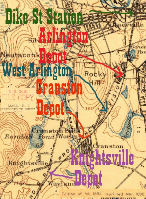
One thing that many of the stops close to Providence have to one another is that they're in Cranston. Because of Edward Ozog's site, I knew that the depot actually named Cranston (which was later renamed Print Works) would be on Dyer Ave near where that enterprise was. Without Mr. Ozog's pictures, identifying this location would have been harder. The most distinctive feature left from the railroad days is a cluster of very identifiable duplex homes he calls mill housing on the southeast corner of the crossing.
Click on the thumbnail for the full resolution image
| Previous Section |
West Arlington |
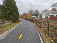 |
Looking northeast towards Providence from the north side of Dyer Ave (11/2023.) |
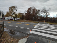 |
Looking southwest towards
Hartford from a similar vantage point as the previous photo. The
crossing we're looking at is that of Dyer Ave, and the Cranston/Print
Works depot would have been on the other side of the road, generally
occupying the left part of the right of way (vintage photos show a two
track main to the right of the building and a frieght house to the
right of that. At the extreme right, there was once a spur curving to
run parallel to the west side of Dyer Ave. This can be seen on Edward
Ozog's site and the 1939 RI aerial photos.
The spur ran to the Cranston Print Works, a large factory just across
Cranston St. The next few photos will deal with this spur, much of
which still exists, before returning to the depot site (11/2023.) |
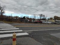 |
This photo is looking at the
same crossing, but facing a bit more north. The spur to the print works
would run through the auto yard and in front of the storefront
(11/2023.) |
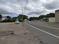 |
Here, we are looking south on
Dyer Ave towards the HP&F. The storefront and car lot from the
previous photos can be seen on the west side of the street, and the
mill housing on the right (the crossing is right in front of the first
white house.) There is a large gray building at the extreme right,
which is occupied by Stiller Distributors. If you look very closely,
you can see tracks embedded in the parking lot running along the
building (6/2024.) |
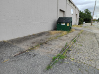 |
Looking north along the surviving trackage of the Cranston Print Works spur (6/2024.) |
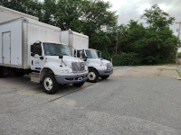 |
Looking north along the Cranston
Print Works spur. The trackway enters and remains in a wooded area
until the former crossing at Cranston St. (6/2024.) |
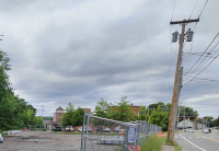 |
This photo is looking north
towards Cranston Print works and the intersection of Dyer Ave and
Cranston St. The spur would have emerged from the woods at left,
crossed Cranston St, and ended up parallel to and left of the large
building with the Cranston Print Works sign (6/2024.) |
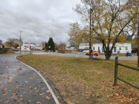 |
Returning
to the mainline, this photo is looking northeast towards the Cranston
depot site, just west of the Dyer Ave Crossing (11/2023.) |
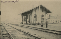 |
The Cranston (Print Works) depot in the Edward Ozog Collection, Providence Public Library. This image is also on his site, and the mill housing along Dyer Ave behind the depot is the most obvious remaining part of this long ago scene. The spur to the Print Works would be on the other side of the freight depot, whose eves are just visible at far left. Photos of the freight depot are on Mr. Ozog's site. This work is licensed under a Creative Commons Attribution-ShareAlike 4.0 International License. |
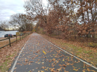 |
This photo is looking southwest towards Hartford from the Cranston Depot site at Dyer Ave (11/2023.) |
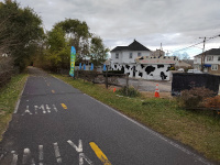 |
This photo is looking southwest towards Hartford from the west side of the Park Ave crossing in Cranston (11/2023.) |
| Next Section |
Knightsville |
Return to Hartford, Providence, and Fishkill Railway Index
(c) 2016-2024 Timothy M Dowd. Last Modified @ 22:47 EDT on 2024-07-08
Made with KompoZer v0.8b3 (20081229)