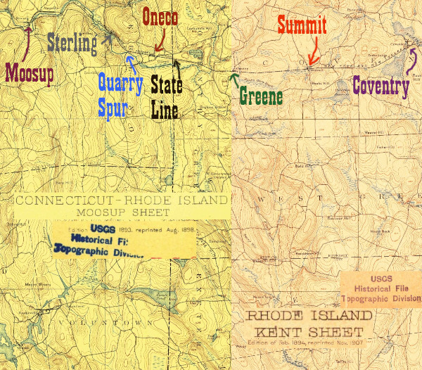
Moosup is one of my favorite places along the Hartford, Providence, and Fishkill/NY&NE. There's quite the diversity of current state of the line- in some places it is open rail trail, in others it is obliterated, in others it is overgrown. There's two impressive bridges, one of which is open to the public, and the community is interested in their history.
Click on the thumbnail for the full resolution image
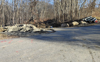 |
Looking towards Sterling across
the Barber Hill Rd crossing in Plainfield. In the summer and fall of
2023, the State of Connecticut has been doing major work in the
Sterling area to upgrade the trail. West of here, in the eastern part
of Moosup, the trail has been paved for some time (12/2023.) |
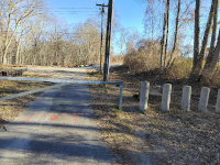 |
Another view of the Barber Hill
Rd crossing, still looking east. This is the beginning of the older
pavement on the Moosup section of the Moosup Valley State Park Trail(12/2023.) |
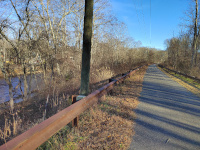 |
This section of the trail offers great views of the Moosup River. This is looking east (12/2023.) |
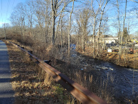 |
Looking west towards Moosup, with a nice river view (12/2023.) |
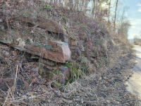 |
A small rock cut close to the village of Moosup (12/2023.) |
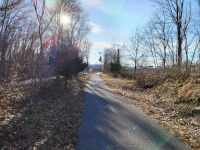 |
Looking west as the line enters downtown Moosup from the east in a winter view (12/2023.) |
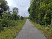 |
Asimilar view, slightly closer to the downtown, in summertime mode (9/2023.) |
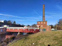 |
A view from the trail of the historic mill operated by the Rogers Corp (12/2023.) |
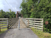 |
There
are two Moosup River bridges. This photo is approaching the eastern
bridge over the Moosup River from the east. This bridge is open to the
public as part of the Moosup Valley State Park Trail. This photo is
from September, 2023 |
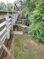 |
A view of the side of the eastern Moosup River Bridge (9/2023) |
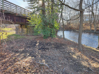 |
The underside of the eastern Moosup River Bridge (12/2023.) |
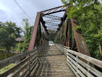 |
Crossing the Eastern Moosup
River Bridge from the East. The white structure visible through the
bridge straight ahead is the modern Cumberland Farms gas station, which
we will use to oritent ourselves later (9/2023) |
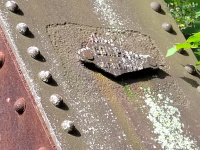 |
The eastern builders plaque on
the eastern Moosup River bridge retains the "of New York" but is
missing most of the "American Bridge Company" name (9/2023) |
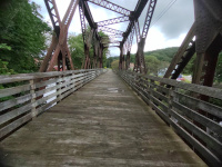 |
On the Eastern Moosup River Bridge (9/2023) |
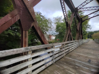 |
On the Eastern Moosup River Bridge (9/2023) |
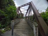 |
A closeup of the western side of the eastern bridge, looking east towards Sterling (9/2023) |
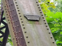 |
The builders plaque on the
western side of the eastern bridge retains the "American Bridge
Company" but is missing the "of New York." (9/2023) |
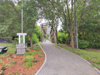 |
At the beginning of the Moosup
River Valley State Park Trail, looking east at the eastern bridge
across the Moosup River (9/2023) |
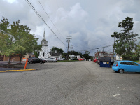 |
Pivoted
180° from the previous
photo, looking towards Moosup. From this point forward until the
western bridge, the right of way is very difficult to trace. Two of the
landmarks we will use to
orient ourselves with vintage photos are visible, the steeple of Moosup
United Methodist Church, and the modern Cumberland Farms Gas Station
(9/2023) |
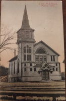 |
This postcard
for the Moosup Methodist Episcopal Church (now Moosup United Methodist
Church) bears a 1911 postmark. The tracks are clearly visible directly
in front of the church. It was postmarked in Moosup and addressed to a
person in Natick, RI, and was thus probably brought the 23 miles east
to Natick on these same tracks. |
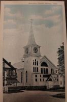 |
This is a later postcard of the
Moosup Methodist Church (now Moosup United Methodist Church.) It was
published by Wm. Bellavance, Inc of Moosup, Conn. It is undated and
unpostmarked, but a plaque in the foyer of the church says that the
clocks, not visible in the first image, were placed there in the 1920s
in celebration of the church's 50th anniversary. In this image a
building, now gone, is between the church and the tracks. The crossing lights appear relatively modern. |
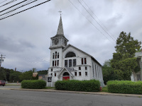 |
Moosup United Methodist Church
in July, 2023. Note that there is no visible remanent of the tracks,
the building to the left of the church is gone, and a large parking lot
with a couple of stores, a Dunkin Donuts, and a storefront church is
present. The enterance to the Moosup Valley State Park Trail is barely
visible behand the Dunkin' Drive through sign |
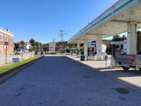 |
This image, shot in October,
2023, is looking east along the ROW from the Cumberland Farms parking
lot. Moosup United Methodist Church is visible behind pump 5 |
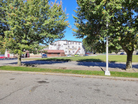 |
This is image is turned 90° from
the previous one. The previous one faced east along the railroad, this
faces north. The most important object in this scene is the tenemant
building in the middle of the image. It will be in the next vintage
image as well, and can help us find the site of the depot (10/2023) |
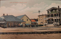 |
The survival of that one
tenemant building shows us where the depot was. It can clearly be seen
behind the windmill in this otherwise unrecognizable photo. Undated,
published by the Rhode Island News Company, Providence, RI and the
Leipzig Berlin Dresden Litho-chrome company of Germany. |
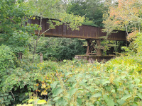 |
The
next visible sign of the
railway is the western bridge over the Moosup River. This marks the
beginning of a 3 mile stretch, all the way to Plainfield, where the
right of way is extant but abandoned and closed to the public. This
trestle simply ends at the eastern abutment- there is no grade here to
connect it to. This is on the east bank of the river looking westward(10/2023) |
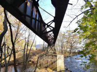 |
This is the western Moosup River Bridge in November, 2023. I am on the west bank of the river looking eastward. ***This is private property and I was granted access by the owners. Please do not enter private land without permission*** |
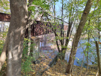 |
This is the western Moosup River Bridge in November, 2023. I am on the west bank of the river looking eastward. ***This is private property and I was granted access by the owners. Please do not enter private land without permission*** |
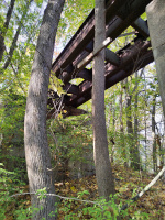 |
This is the western Moosup River Bridge in November, 2023. I am on the west bank of the river looking westward. ***This is private property and I was granted access by the owners. Please do not enter private land without permission*** |
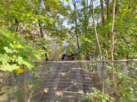 |
This is the western Moosup River
Bridge in November, 2023. I am on the west bank of the river looking
eastward at the top of the bridge. ***This is private property and I was granted access by the owners. Please do not enter private land without permission*** |
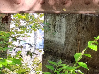 |
The State of Connecticut Bridge
number for the western Moosup River Bridge, 09908R. It is still on the
state inventory of rail bridges, and can be seen, for example, here: Railroad Bridge Management Program on page 84. ***This is private property and I was granted access by the owners. Please do not enter private land without permission*** |
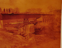 |
An historic view of the western
Moosup River bridge during its construction, courtesy of James
Mortimer. He points out the the Moosup United Methodist Church is
visible just at the end of the trestle in this photo. |
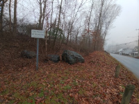 |
After crossing Plainfield Road
at a wide enough diagonal that the roadbed runs nearly parallel to the
road for a ways afterward, we are greeted with our first example of the
state owned roadbed that is totally abandoned and off limits to the
public. The right of way runs parallel to Plainfield Rd up to about the
location of Backus Plainfield healthcare center, when the road starts
to curve north and the railroad continued straight. I don't know why
this section isn't added to the Moosup Valley Rail Trail State Park- it
would be a valuable car free route between Moosup and Plainfield. The
western bridge and right of way in Moosup village could continue to be
bypassed by local roads. (12/2023.) |
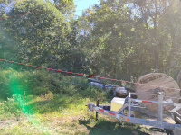 |
Looking east along the HP&F/NY&NE roadbed where it crosses under the Connecticut Turnpike. This view,
from September, 2023, was whilst a utility project was ongoing and
materials are stacked on the otherwise abandoned right of way. |
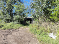 |
Looking east along the
HP&F/NY&NE roadbed where it crosses under the Connecticut
Turnpike. The disused underpass is clearly visible. The Connecticut
Turnpike (I-395 today) opened in 1958 whilst the tracks into Moosup
weren't abandoned until 1969 (according to locals) and thus the tunnel
did see use for about a decade. The abandoned roadbed continues towards Route 12, where I continue to discuss it on my Plainfield page (9/2023.) |
Return to Hartford, Providence, and Fishkill Railway Index
(c) 2016-2024 Timothy M Dowd. Last Modified @ 01:11 EST on 2024-01-01
Made with KompoZer v0.8b3 (20081229)