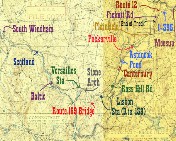
The railroad within the limits of the Connecticut town of Plainfield (which includes the village of Moosup) is a microcosm for the whole line. There is a rail trail with restored bridges, totally abandoned line with totally abandoned bridges, and active rail. This page attempts to pick up from where we left off in Moosup.
The section between Plainfield Junction and Willimantic, which begins in the Rawson Quarry but is formally chained milage-wise from Plainfield Junction, is very much active rail. All of this land is legally posted by the P&W railroad, so finding places to photograph involves looking for crossings. One great place to see the railroad is the large trestle across the Quinebaug River, which is dammed in Jewett City to create Aspinook Pond.
Click on the thumbnail for the full resolution image
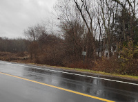 |
Looking
east at the HP&F's crossing of Connecticut Route 12 in Plainfield.
Note the "State Property No Tresspassing" sign. This heads towards the
unused tunnel under I-395. |
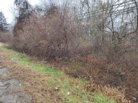 |
Looking west from the HP&F
crossing of Connecticut Route 12 in Plainfield. Note that in the
massive thicket in the middle of the image there is a similar "STATE
PROPERTY NO TRESSPASSING" sign as on the other side. This marks the
roadbed (12/2023.) |
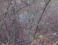 |
A cropped version of the previous image, showing as best as possible the state No Tresspassing sign (12/2023.) |
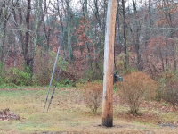 |
The roadbed running west from Route 12 as seen from that road (12/2023.) |
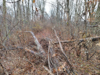 |
This photo is facing east, as
close as I can possibly get to the photo above. It is just after the
location I assume is the Horse Brook bridge. The only way I could climb
over that pile of debris would be in a Tyvek suit, because I am quite
allergic to poision ivy. I entered from the Pickett Road Crossing,
where the roadbed east of the crossing was not marked as No Trespassing
(12/2023.) |
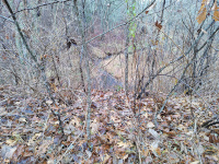 |
This is looking north at Horse
Brook from the roadbed, which is on a large viaduct. Given the babbling
noises and that Horse Brook seems to cross here, I suspect I am
standing above a stone box culvert that the state of Connecticut Railroad Bridge Management Plan refers to as Bridge 09909R.
Unfortunately I was not able to get down and see, as the undergrowth in
December, 2023 was dense and property lines unclear. Given that the
bridge is listed as a box culvert and I couldn't see anything of it, I
suspect it is much like a similar site near Allerton Farms that can be seen in this photo. |
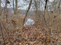 |
This is looking south at Horse Brook from the roadbed, which is on a
large viaduct. Given the babbling noises and that Horse Brook seems to
cross here, I suspect I am standing above a stone box culvert that the state of Connecticut Railroad Bridge Management Plan refers to as Bridge 09909R.
Unfortunately I was not able to get down and see, as the undergrowth in
December, 2023 was dense and property lines unclear. Given that the
bridge is listed as a box culvert and I couldn't see anything of it, I
suspect it is much like a similar site near Allerton Farms that can be seen in this photo. The white house in the distance is on Rte 12. |
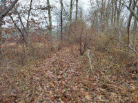 |
Facing east towards Moosup and Rhode Island (12/2023.) |
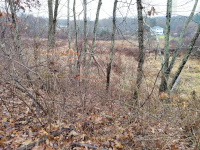 |
Looking south into the Horse Brook meadow (12/2023.) |
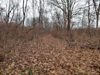 |
The roadbed looking east just east of the Pickett Rd Crossing (12/2023.) |
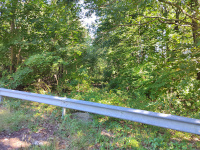 |
A summertime view of the Pickett Road Crossing Facing East (9/2023.) |
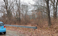 |
A wintertime view of the Pickett
Road Crossing Facing East. Unlike on Route 12 or on the west side of
Pickett Road, I didn't see a state no tresspassing sign in December,
2023 when I explored this section, thus I deemed it ok to enter. Please
do not take this as legal advice. As the previous photos show, this
section is totally abandoned and entrycould be hazardous. (12/2023.) |
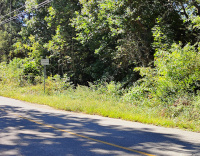 |
A summertime view of the Pickett
Road Crossing, facing West. Note that this side is posted State
Property No Trespassing (9/2023.) |
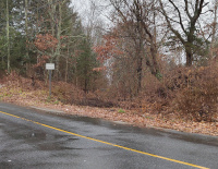 |
A wintertime view of the Pickett Road Crossing, facing West. Note that this side is posted State Property No Trespassing (12/2023.) |
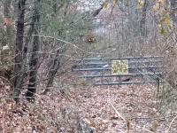 |
At the Pickett Road Crossing,
zoomed in on the gate blocking the roadbed heading west. According to
the sign this section is part of a wildlife sanctuary. It has to be a
relatively small one, as we are not far from the Rawson Materials
quarry and the beginning of the Providence and Worcester tracks to
Willimantic- the beginning of easternmost section of the old HP&F
that still has rail service. (12/2023.) |
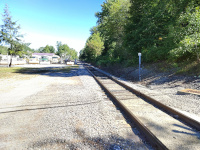 |
At the Cemetery Road Crossing,
looking east. We are looking at the Osterman propane yard, and this is
the easternmost active rail crossing of the HP&F on a public road
(9/2023.) |
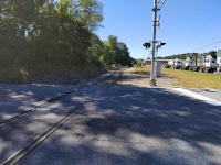 |
At the Cemetery Road Crossing, looking west. We are looking into the Providence and Worcester Plainfield Yard (9/2023.) |
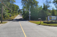 |
Cemetery Road Crossing, Plainfield. This is the easternmost active rail crossing of the HP&F on a public road (9/2023.) |
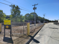 |
Providence & Worcester Yard, Plainfield from Cemetery Road (9/2023.) |
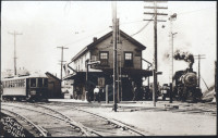 |
An early 20th century view of Plainfield Junction Station. This photo came from Wikipedia,
which claims it is a public domain scan of an old postcard and that the
steam train is on the NY&NE/HP&F and headed towards Providence.
That would mean that we are looking towards the south. Wikipedia claims
this is between 1907-1915. |
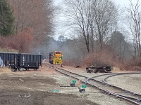 |
Looking north towards Plainfield
Junction from Railroad Ave. The AOKX gondolas are on the HP&F as it
curves southwest away from the Norwich & Worcester. The track to
the right is also the HP&F, heading towards its current terminus in
the Rawson Quarry, but in general towards Providence. The
locomotives are idling on the passing siding along the N&W
that extends from Cemetery Road to the HP&F. (12/2023.) |
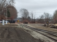 |
A similar view to above but from
a wider angle. This location was made famous in the 1959 movie "It
happened to Jane" where a passenger train pulled by FL9 2008 is coming
from Moosup on the HP&F (from the right) with a J class 2-8-2 steam
locomotive is coming from Worcester on the N&W. (12/2023.) |
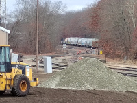 |
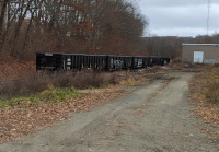
A train of covered hoppers on
the HP&F just east of Plainfield Junction. This is taken from
Railroad Ave just west of where the previous two photos were taken
(12/2023.) |
 |
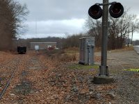
A string of AOKX gondolas on the HP&F main slightly west of Plainfield Junction (12/2023.) |
 |
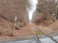
Railroad Ave Crossing facing
East towards Plainfield Jct. Note that this crossing is signed as "MP
0.17." The mile markers discussed on this website refer to the original
ones given on the 1870 HP&F timetable from Providence to Waterbury,
with the numbering continued west of Waterbury based on miles given on
later NYNH&H timetables. But the line itself has had many different
ways of counting miles, and the current operator of this segment, the
Providence & Worcester, starts its mile 0 at Plainfield Junction
and counts up as one moves west. This will matter to us because a few
of these mile markers are visible from public spaces. (12/2023.) |
 |
Railroad Ave crossing facing west towards Packerville (12/2023.) |
Return to Hartford, Providence, and Fishkill Railway Index
(c) 2016-2023 Timothy M Dowd. Last Modified @ 22:48 EST on 2023-12-19
Made with KompoZer v0.8b3 (20081229)