 (12/2001)
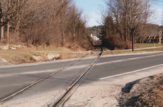
Eventually it must cross the highway, because the tracks are once again down from the lime plant on the eastern end of town towards about 200 yrds. west of Union Station. These begin on the north side of CT 44. There is an active crossing at Rt. 44 just east of the station (this picture looking towards Hartford:)
 (12/2003.)
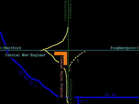
The Central tracks cross the Housatonic Line at the station itself at a + intersection (see below), so spur tracks run from the CNE to allow a train on the Central to move south (left) and then north (right.) This diagram should explain this:
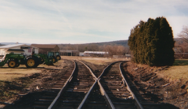
This is where the south spur comes off of the main track(the right track:)
 (12/2003.)
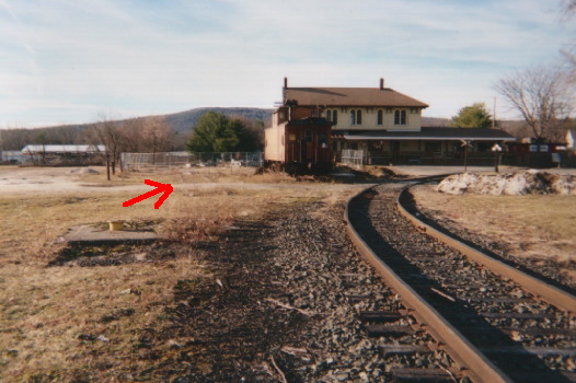
The right track in the above picture is the Central main line for a few tens of yards, and then the spur would have switched off while the CNE went right into the station. Now, only the spur is maintained. The last time the CNE mainline west of where the switch was would have been used would have been when all the cabooses seen below were delivered (sometime in the mid 1990s,) and the switch itself has been removed: the red arrow shows the Central main.)
 (12/2003.)
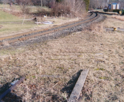
Leroy Beaujon points out that this picture is also interesting because of the cement piece visible below where we drew the arrow. This was actually part of the apparatus neccesary to water the tenders on the steam engines that would have operated on the CNE. There once was also one in the yard west of the Housatonic (see next page.) Mr. Beaujon thinks that the last time these would have seen use would have been in the 1920s or 30s. Looking from the other side, the old ties of the removed part of CNE mainline are just barely visible:
 (12/2003)
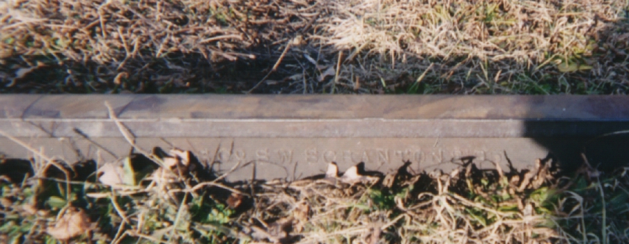
The track on the spur is fairly heavy weight and dates from the 1980s, while that on the Central main is much older:
 (12/2003)
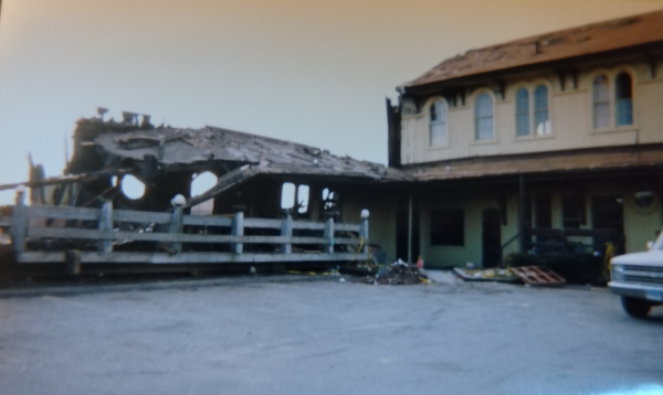
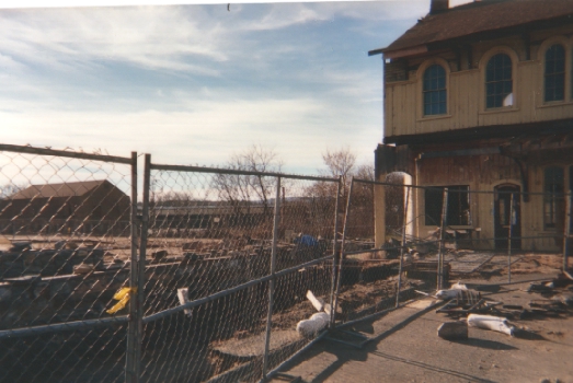
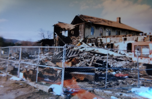
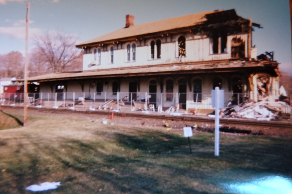
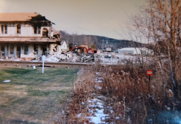
Before continuting, it is neccesary to talk about the current state of Canaan Union Station. The map above shows it to be an "L" shape, which it historically was and has since become again. Canaan Union Station was long considered a gem of the northwest hills, having been built in the 1870s by the Housatonic Rwy. and the Conncticut Western. Unfortunately, in the fall of 2001 kids playing with matches lit a fire next to restaraunt that was occupying the Central New England side of the station, completely destroying that half. The station was L shaped, and at the elbow had a magnificent cupola, which was also destroyed in the fire. Heroic efforts on the part of firefighters was able to save the Housatonic side of the station, and in the 20 years since all this happened, the station has been rebuilt. Some of the pictures below date from Dec. 2001, right after the fire. Others were from two years later (Dec. 2003) and showed that the foundation has ben excavated and the surviving part sealed. Although this website is mostly suspended in time around 2003, I've added some photos from 2023 to show the rebuilt station. The news of the fire prompted dismay among rail fans and residents of the Northwest hills alike, as this was truly a beautiful building. This web page was created hastily, although the best tribute to the station was that of Mr. Beaujon, who grew up in the Northwest Hills and remembered working for the New Haven Railroad in the area. Just to show what this poor station has been through, here's a view of the parking lot on the north side in December, 2001:
 (12/2001.)
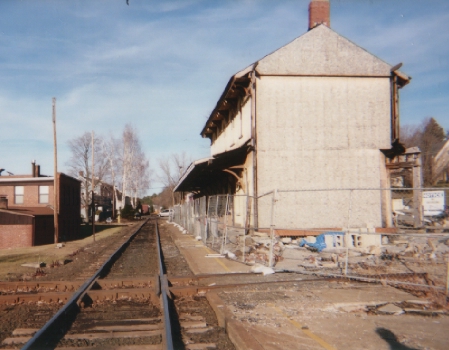
Here's a shot from a similar angle with the foundation prepped for new building:
 (12/2003.)
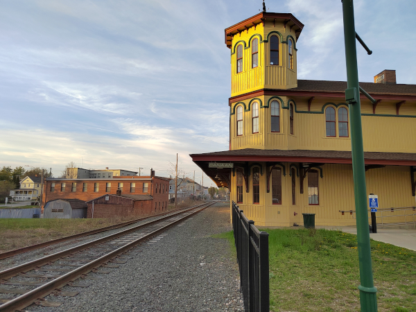
Finally here's a photo of the restored station. The rebuilt part is closest to the camera:
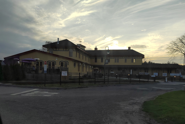 (4/2023.)
This site was written in the early 2000s and most of the research and photos here reflect the condition of the station at that time, but it wouldn't be fair to ignore the work that was done to fix this.
In the April, 2023 photo above, the spur from the southbound Housatonic to the eastbound CNE main (now a spur to the quarry) is clearly visible in good condition. Here is a closer view of it twenty years earlier:
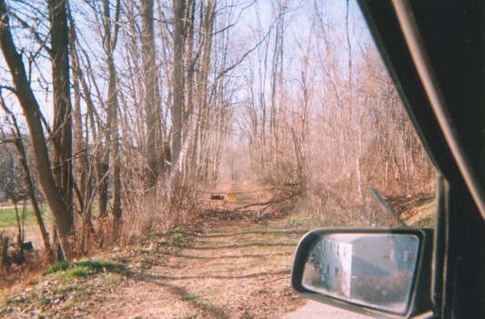
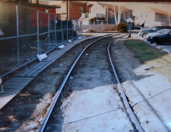 (12/2001.)
Moving west along the Central New England main- this section of the main was gone by 2023:
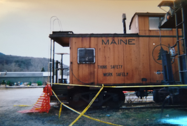
 (12/2001.)
Here is another look at that caboose, Maine Central MEC 658.
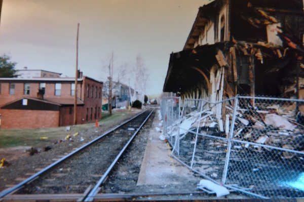
 (12/2001.)
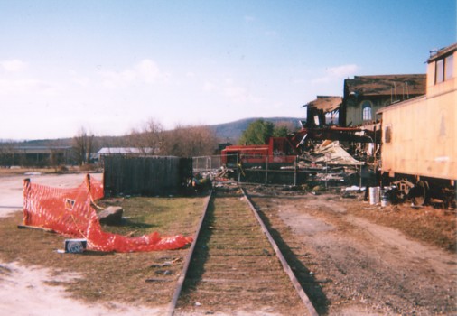
A look north at what's left of the original CNE side of the station after the fire- the tracks can be seen running under the debris. Note that not all of the Housatonic side of the station survived- this shot clearly shows the southern section was lost along with the tower:
 (12/2001.)
Further west, we have a view of the diamond between the CNE (left-right/ east west) and the Housatonic (north-south/ up the surviving platform) just after the fire:
 (12/2001.)
A similar shot from two years later, showing the diamond better
 (12/2003.)
Twenty years later the station is totally restored, complete with a Penn Central era platform sign. But alas, the diamond and the Central New England main are no more.
 (4/2023.)
Looking back at the Housatonic side of the station from the CNE mainline to the west:
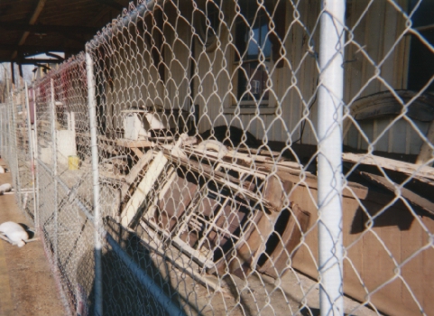
 (12/2001.)
Inside the fence along this platform, is a pile of trim which is presumably from the CNE side. I wonder if it was put back on the restored building:
 (12/2003.)
Twenty years later, it's difficult to tell the old part of the building from the new. If you get very close you can see the characteristic paint chips of old oil based paint and where it abruptly ends. But it's virtually seamless.
 (4/2023.)
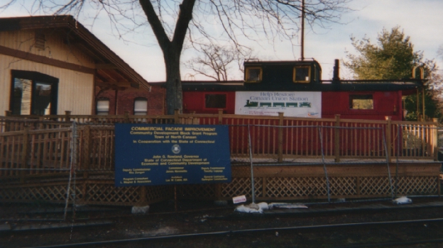
The north side of the station. Note the sign on the caboose inviting visitors to contribute to the restoration fund.
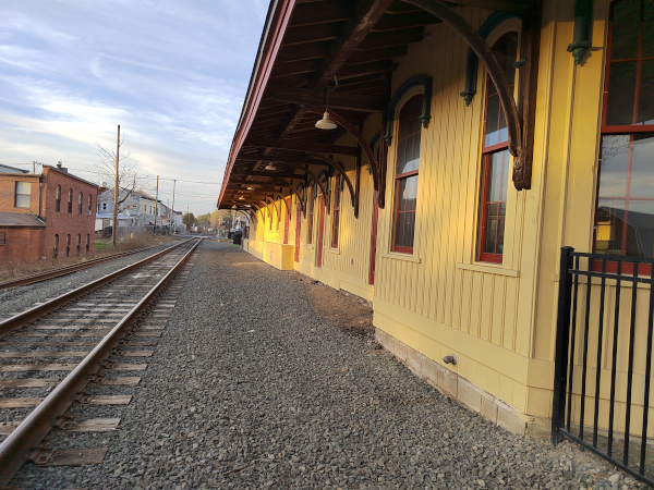
 (12/2003.)
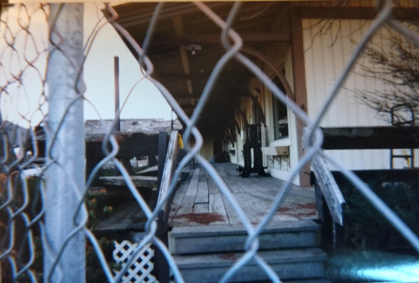
A view down the northeastern porch adjacent to the spur connecting the eastbound CNE and southbound Housatonic on the north side of the station:
 (12/2001.)
Back on the west side of the station, this photo is facing west towards the CNE main from the Housatonic platform area. The CNE main tracks are still present in 2023 in the brush, and amazingly the stop sign we'll see in the next photo (from 2001) appears to still be protecting the diamond.
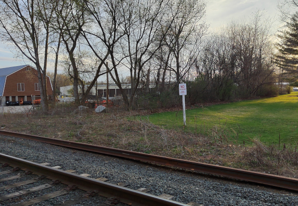 (4/2023.)
Looking back east towards the diamond from the CNE main. Note the stop sign still present 22 years later in the above photo:
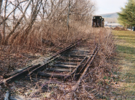
 (12/2001.)
Looking west along the CNE main towards two cabooses:
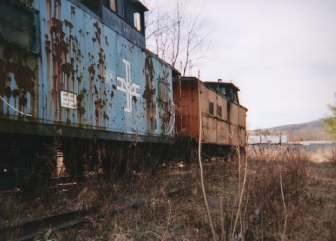
 (12/2003.)
A closer shot of the nearer caboose, which appears to be Boston& Maine BM 462.
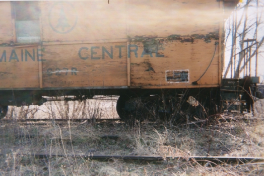
 (12/2003.)
A closer shot of the further caboose, which appears to be Maine Central MEC 627R.
 (12/2003.)
back to the Central New England Index