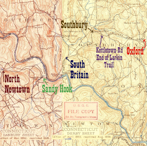
As has been seen on the Oxford/Southford page, the NY&NE enters the town of Southbury from the east on the well maintained Larkin State Rail Trail/ Bridlepath. That changes at Kettletown Road, however, where the railtrail ends. The driveway to the former IBM campus in Southbury initially occupies the right of way, but Interstate 84 cuts right across the top of the former loop through town so that the location of the former depot is on the opposite side of the highway.
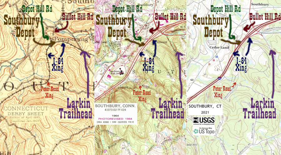
The former railroad right of way will spend the next 3 or so miles extremely close to the modern Interstate 84 right of way- crossing it at least three times total. The landscape has changed so much over the last 130 years that I felt I needed three generations of USGS topographic maps to fully explain: 1893, 1984, and 2021. To try and locate sites I used three sets of aerial photos: 1934 (image 4283,) 1965 (image 1669,) and the current (2024) Google Maps. In general, this work showed that the depot was at the Bullet Hill Road crossing of the railroad (and later the Bullet Hill Road overpass of I-84) west of the intersection with Depot Hill Road. A comment by a user named Rich on the IridetheHarlemLine blog confirms this. As of 2024, Bullet Hill and Depot Hill Roads have had their paths change quite a bit, with Depot Hill being truncated, and Bullet Hill becoming essentially a second driveway for the former IBM campus. To the best of my knowledge, the depot site today is in the backyard of the Stone Family Crematorium, between their facility and I-84.
The looping NY&NE right-of way turns around at the depot, and heads almost due south. Right at the point where it crosses Peter Road it turns west and serves as a right of way for a pipeline as it runs parallel to I-84. This page will detail photos until exit 14 (South Britain,) whereas the next page, South Britain, will deal with the right of way throughout the rest of Southbury to the Housatonic River.
Click on the thumbnail for the full resolution image
 |
Looking
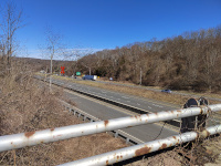
towards Waterbury and Providence from the Bullet Hill Rd overpass. I've
added a large orange X to show where the NY&NE's loop through
Southbury would have first crossed the modern highway right-of-way
(3/2024.) |
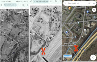 |
Using vintage aerial photos and Google Maps to locate the depot. I used three sets of aerial photos: 1934 (image 4283,) 1965 (image 1669,) and the current (2024) Google Maps.
This picture is not expandable because all three images are under
copyright, and I claim that this low resolution lineup for the purposes
of showing my determination of the depot location qualifies as fair use. |
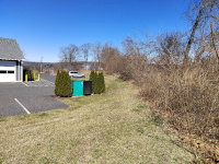 |
My best guess is that at least
part of the Southbury Depot, were it still standing, would be in this
photo. It would probably be in the brush to the right (beyond which is
a sloping hill down to I-84) and part would be behind where I'm
standing. In the distance we can see two large tanks that are also in
the photo from 1965 (image 1669,) and the building at left is the Stone Family Crematorium (3/2024.) |
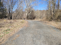 |
Looking east at the Peter Road
Crossing. There are two parallel driveways that vaguely occupy the
right of way, which in general here cuves towards the north and
approaches the depot site at Bullet Hill Rd north of I-84. The pipeline
whose markers we can see here continues eastward when the ROW veers
northward- this is easiest to see on the 1984 map (the center of the
three, above) (3/2024.) |
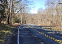 |
Looking north on Peter Road
towards the NY&NE crossing. At right, we can see the two driveways
vaugely along the right of way. At left, we can see the right of way,
now occupied by a pipeline, heading west towards South Britain (3/2024.) |
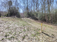 |
The NY&NE right of way
looking west towards Danbury and the Hudson at Peter Road. This portion
will carry a pipeline until it diverges from it at the Exit 14
interchange (3/2024.) |
 |
The NY&NE roadbed, as seen
from a car on I-84. It is running parallel and south of I-84 at this
location, between Peter Road and Exit 14 (3/2024.) |
Next: South Britain
Interesting Discussion of the NY&NE in Southbury:
https://www.iridetheharlemline.com/2010/12/03/history-of-my-hometown-the-railroad-in-southbury/
Return to Hartford, Providence, and Fishkill Railway Index
(c) 2016-2024 Timothy M Dowd. Last Modified @ 21:43 EDT on 2024-03-31
Made with KompoZer v0.8b3 (20081229)