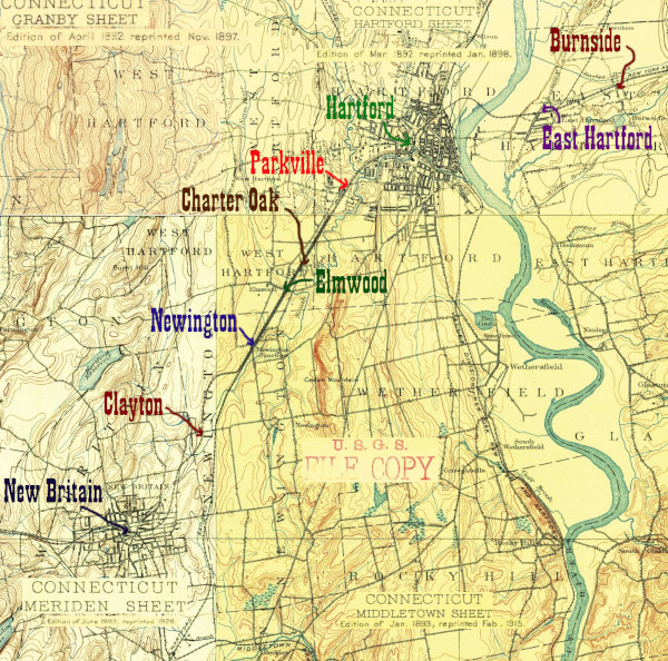
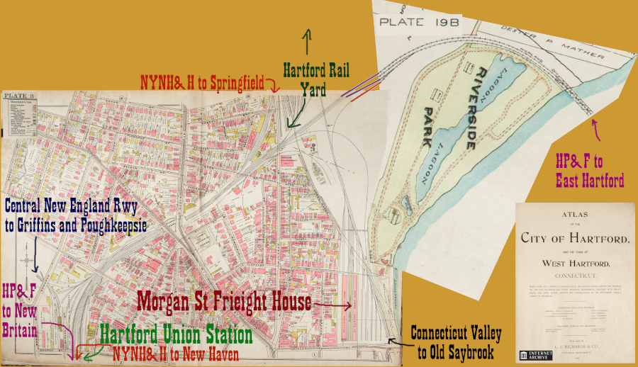
A 1909 map of Hartford made from plates in the LJ Richards Atlas. Available on the Internet Archive.
Hartford's railroad infrastructre is fascinating in the sense that the 1890s USGS map and 1909 city atlas above still basically show what's on the ground today. The HP&F enters the city on a bridge, passes through the Hartford Yard (where a connection to the CT Valley line lies,) joins the Hartford Line from Springfield, Mass, and finally the Central New England line from Griffins before entering the 1889 Hartford Union Station. The Hartford Yard (today operated by Connecticut Southern) is much smaller than in the past, the CNE only goes to Griffins, and the HP&F trackways south and west of the station have been replaced by Bus Rapid Transit, but this is still a busy transit corridor with lots of passengers and goods getting where they need to go.
The section of the Hartford, Providence, & Fishkill/ New York & New England right of way between Hartford and New Britain was pressed into service as the CTfastrak Bus Rapid Transit (BRT) line in 2015. At present, this is one of only two places on the entire line (the other being a small portion of the Northeast Corridor) where one can actually ride mass transit on the line, albeit on a bus.
The busway has been controversial among railfans for the loss of railroad miles and among taxpayers for its cost. Personally, I think this op-ed by a UCONN student, Thess Johnson, gets it right. The busway exists, and for whatever trouble went on in building it, it works pretty well. My wife and I recently decided it would be fun to eat at a number of places in Downtown Hartford on a weekend afternoon, and parking in the suburbs and taking the bus in made it very hassle free. I'd rather have a train, but I like having good public transit.
The HP&F right of way is served by CSO freight trains until Hartford Union Station. There is an abandoned bridge on the south side of the station that used to carry trains to and from New Britain; the corresponding bridge on the north side has been removed. Somewhat underwhelmingly, there's no dedicated platform for the CT Fastrak, which makes its stop on Asylum Street at an ordinary city street bus stop just east of the station. This allows the buses to run locally on city streets to a final stop at Travelers/ the Wadsworth Atheneum. Boarding a CTfastrak bus here will have you proceeding west on Asylum, turning left onto the I-84 onramp at Spruce Street, but then taking a special busses only left exit from the on ramp which leads to the old HP&F right of way.
As always, these photos proceed as if you were heading west from Providence towards the Hudson
Click on the thumbnail for the full resolution image
| Previous Section |
East Hartford |
 |
A
19th Century Seat Check, from the HP&F or one of its successors. |
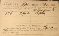 |
A
NY&NE issued postcard advising someone they
have a boxcar of potatoes waiting for them. Note that the boxcar is at
Morgan St. Presumably this means the NYNH&H frieght operations at
Morgan Street (12/1893.) |
 |
The back of the freight postcard (12/1893.) |
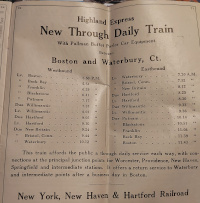 |
An advertsment for a new "Highland Express" train in the October, 1913 timetable. This is Highland Express/Nutmeg service, and it lasted until Hurricane Diane destroyed an Air Line bridge in 1955.
Although at this time the New Haven Railroad was operating the entire
HP&F railroad, they were using different parts of it differently.
Waterbury to Willimantic service was connected to service north on the
Air Line connecting to Franklin and Boston. The two conductor's cash
fare tickets below show the HP&F stops between Waterbury and
Willimantic as listed with this service, and no other HP&F stops.
Courtesy of James Mortimer. |
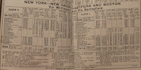 |
A section of the April 1937 Form 200 timetable, showing service between Hartford and Boston. The
service offers passengers a choice on how to make their connection-
through Willimantic or through Springfield. The Willimantic service
(which would run along the HP&F mainline between Willimantic and
Hartford) is clearly considered the secondary choice, as it required a
train change in Hartford for onward service to New York, whilst the
service through Springfield had many trains that traveled through
Hartford to New York (4/1937.) |
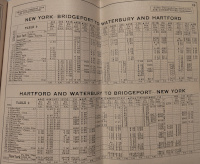 |
Another section of the April
1937 timetable, showing service along the HP&F mainline between
Hartford and Waterbury as essentially being an extension of today's
Metro North Waterbury line. One can't help but wonder if a restoration
of this service might one day make sense again. Track would need to be
relaid between New Britain and Newington Jct (it was removed for the
busway) to connect with the Springfield Line. Although the busway
replaces half of the former 4 track main between Newington and
Hartford, the other two tracks seem sufficent for additional service.
(4/1937.) |
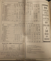 |
A third section of the April
1937 Form 200 timetable. showing service along the HP&F east of
Hartford as being seen as part of Hartford-Boston service, with trains
switching from the HP&F at Willimantic to the branch to Blackstone.
There is no mention of any passenger service east of Willimantic on the
HP&F mainline with the exception of a motorcoach service from
Providence to Washington, RI clearly paralleling a former passenger
rail service. There is no passenger service at all listed between
Willimantic and Washington, RI (4/1937.) |
 |
An early 20th century New Haven
Railroad conductor's cash form 32 ticket, sold between New York and New
Haven. It was not used on this line, but does list station stops
along it. The ticket is undated but was with a collection of similarly
weathered New Haven tickets with November 26, 1918 penciled on their
backs. |
 |
A
mid-20th century conductor's cash form 3 ticket, sold between New
Britain and Hartford and thus an artifact linked to this branch. It is
undated, but does not list Crescent Beach, Sound View, or South Lymeas
local stops along the Shore Line, so based on their dates of
abandonment on the Tyler City Station site, this suggests this ticket
is from the 1930s or later. Note that compared to the earlier form 32
ticket above, there are more local stops listed between Waterbury and
New Britain. This too suggests it was used for servce between Waterbury
and Boston, with a switch from the HP&F to the Air Line at
Willimantic. |
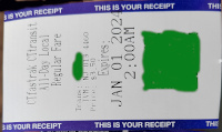 |
A paper Connecticut Transit all day bus fare as it appeared in 2023. The QR code has been removed. I bought this for service between Newington Junction and Hartford (and ultimately used it at Flatbush Ave and Kane St, too.) |
 |
My CT Fastrack ticket (defaced) from a day exploring the HP&F between East Street and Hartford (6/2024.) |
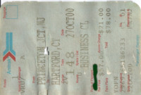 |
An Amtrak ticket to Hartford Union Station (10/2000.) |
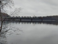 |
A freight train, CSO-3, crosses
the HP&F bridge over the Connecticut River from Hartford to East Hartford. This view is
looking north from the Riverside Park boat launch, with Hartford on the
left and East Hartford on the right. This train won't be on the HP&F
tracks for long: at the East Hartford Yard it will switch to the Armory
Branch, known currently as the East Windsor Secondary (4/2024.) |
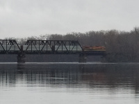 |
A closer view of one of CSO-3's locomotives (4/2024.) |
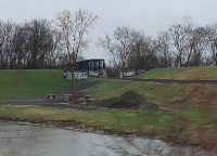 |
A view of the start of the
Connecticut River bridge on the Hartford side. Note the flood control
infrastructure that trains must pass through (4/2024.) |
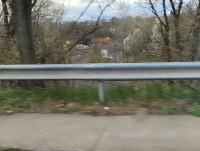 |
A view looking west from the
Reverend Moody Overpass. The Connecticut Southern yard can be seen in
the distance. The track seen here and the road (which is Weston Park
Road) both curve around the music venue currently known as the Xfinity
Theatre and eventually run to the north. Not visible but from recent
satellite images still seems to be extant is the HP&F main which
should be to the south (left) of the track visible here. Eventually
they connect and head east to the bridge as seen above. (4/2024.) |
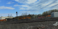 |
Looking east into the Connecticut
Southern Yard from Windsor Street. Identifiable in this photo (and
verified using contemporary posts on the Connecticut Southern Facebook
page) are Providence and Worcester locomotive PW 4003 (a B40-8 built by GE in 4/1988 for the New York, Susquehanna, and Western,) and New England Central locomotive NECR 3855 (a GP38 built by EMD in 8/1969 for the Gulf, Mobile and Ohio.) Less certainly the partial photo might be of NECR 2151 (a GP38-2 built by EMD in 1/1973 for the Missouri Pacific,)
as it was working with 3855 around that time according to photos on the
CSOR Facebook group. The engine in back is unidentified (4/2024.) |
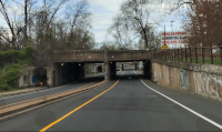 |
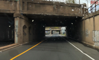
Looking north at the HP&F tracks over Windsor St on their way to the yard. The yard is to the right (east) (4/2024.) |
 |
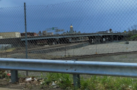
A closer (northward) view of the
overpass carrying the HP&F mainline over Windsor St. The 1937 build
date is clearly evident, placing this build some 40ish years into the
NYNH&H ownership. Note the overpass carrying the tracks to
Springfield in the distance (4/2024.) |
 |
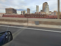
A view looking south from the
Walnut St overpass towards Hartford Union Station, whose platform
canopies can just be seen in the distance, under the I-84 viaduct
directly in front of the State Capitol. The tracks in the foreground
are that of the Central New England Railway, and once went to Poughkeepsie
(to the right.) The tracks in the background lead to Union Station,
although the western track deadends before the Church Street bridge. According to the Wikipedia article on Union Station,
the structure of the platforms is currently only strong enough to
support one train at a time. It does not cite a source for this, nor have I found another one, but it
may explain the reason only one track is available at the formerly 4
track station. (4/2024.) |
 |
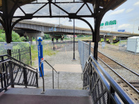
A view of the roof of Hartford
Union Station from atop the I-84 viaduct. This is the side of the
station with the tracks- the canopies for the platforms are just
visible (5/2024.) |
 |
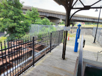
The north end of the in-use
platform at Hartford Union Station. I am standing in front of a locked
gate on a raised section that takes up part of the north end of the
island platform, which is where all trains now call at Hartford, which
has 2 full length platforms and once had 4 tracks. The partial rebuild
of this platform to make it high level whilst ignoring the rest of the
platform space is because of the possibly temporary nature of the
situation. The I-84 viaduct looms in the distance, and this article in the Hartford Courant
explains the situation: there is great uncertainty how Interstate 84
will be rebuilt or retained. Despite the building of the Fastrak
busway and the rebuilding of the Hartford Line as a commuter line, CDOT
doesn't want to rennovate the platforms here in case new platforms will
need to be built due to changes in the highway. The track at right is
the only through track at Hartford. The track at left is the HP&F
main, but it obviously ends just before the station (6/2024.) |
 |
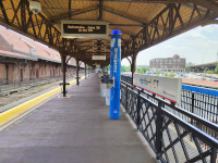
A photo from a similar vantage
point to the one above, turned slightly to show the abandoned HP&F
Bridge over Church St. Note that the HP&F main, now terminating
just north of the station, would have used this bridge and trains would
use the island platform on its west side. Also note the vintage Amtrak
sign with its "pointless arrow" (6/2024.) |
 |
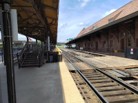
Looking south along the island
platform from the same spot as the previous two photos. This is now the
only place in the station trains stop. At far left we can see the
abandoned side platform that formerly served Springfield Line track 2,
and at far right we see a metal fence sealing off the HP&F trackway
from the island platform that used to serve it (6/2024.) |
 |
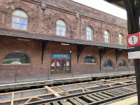
Looking north at the new high
level platform added onto the island platform. Formerly, boarding at
HFD involved the car steps and the low level platform (6/2024.) |
 |
The main station signboard and former entrance to the side platform (6/2024.) |
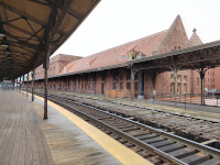 |
On the south side of the island platform, looking north. It looks suspended in time, not appearing much
different than when the author regularly used it from 2000-2003 or even from
the early 1990s. The extant track serves the Springfield line only, and
the abandoned platform would have also served the Springfield Line.
Highland
Division/HP&F trains would call at the other side of the near
platform, which is really an island, discussed further below. Note that
at this time there was nothing to suggest that trains no longer call
here- all access is from the new raised platform at the other end
(12/2023.) |
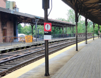 |
Six months after the previous photo, warning signs alerting passengers that trains don't stop here have been added (6/2024.) |
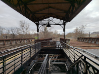 |
Looking south from the south end
of the Hartford Union Station island platform. This view shows clearly
the 4 trackways that once served the station. Only the near track on
the left now serves Hartford Line trains. The two trackways on the
right end fairly soon after the bridge at the fencing: these would have
served Highland Division/HP&F trains.This is the space now occupied by the CTFastrak busway, discussed below (12/2023.) |
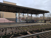 |
Looking east at the south end of
the platform from a similar vantage point from the photo above. We see
the south end of the abandoned side platform and its stairs down to
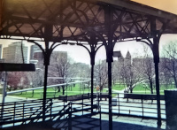
Asylum St. If one looks hard, they can see the two bars hanging down
over the staircase that once supported a platform nameboard (12/2023.) |
 |
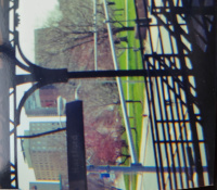
A similar view from a train on
the surviving track in 2001 or 2002. Note that at this time, the
platform sign was still in place. |
 |
Detail on the sign from 2001 or 2002. Just to the left of the visible part was the Amtrak "Pointless Arrow" logo |
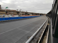 |
Looking north along the empty
HP&F/Highland Division trackways at Hartford Union station from the
same place on the platform as the above photos (12/2023.) |
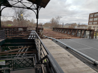 |
Looking south from the island
platform at Hartford at the empty Highland Division/HP&F trackway
and bridge over Asylum St. Note that on the staircase there is a sign
pointing the way to the CTFastrak stop. Since this bus rapid transit
(BRT) system will occupy the HP&F right of way all the way to New
Britain, we will board the bus at the end of this page. First there are
more pictures of the 1889 station itself (12/2023.) |
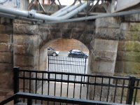 |
The landing partway down the
external staircase from the island platform. Note the brickwork and the
traffic on Asylum St (12/2023.) |
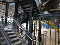 |
The stairs up to the island platform from street level on Asylum St (12/2023.) |
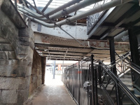 |
Looking west on Asylum Street
under Union Station. The bridgework holding up the HP&F/Highland
Division trackway is in the foreground (12/2303.) |
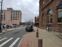 |
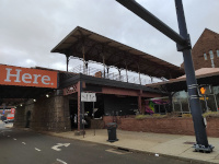
Looking south along Union Place with the station to the right. Note the state capitol in the distance (12/2023.) |
 |
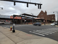
Here we can see the south end of
the abandoned side platform from street level. The stairs seen in the
platform level photos are easy to see here (12/2023.) |
 |
Looking north at the corner of
Asylum St and Union Place. This gives one of the best available overall
views of the Richardsonian station (12/2023.) |
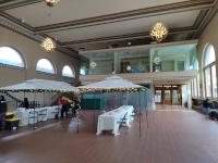 |
The waiting room at Hartford,
looking north. Some sort of festival is going on. The tracks and busses
are to the left and Union Place is to the right. Note that there's two
staircases running along the western wall. These lead to the abandoned
side platform that once served the Springfield line (12/2023.) |
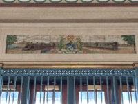 |
Tilework at the top of the main staircase that goes to the abandoned side platform. The Latin inscription is the motto of the City of Hartford: Post Nubila Phoebus ("after the clouds, the sun.") (6/2024.) |
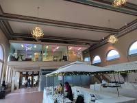 |
Inside Union Station, looking south (12/2023.) |
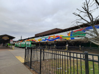 |
A view of the west side of the
station, looking north from near the corner of Asylum and Spruce
Streets. Immediately behind the tile mural above the bus bays is the
abandoned HP&F/Highland division trackways. The top of the island
platform canopy is visible, as is the roof of the station (12/2023.) |
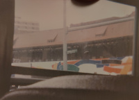 |
A similar location in 1991 or
1992, taken from the raised vantage point of a school bus. It clearly
shows the train platform behind the tile mural. Taken by either the
author or his brother Rob on an elementary school trip with 110 film. |
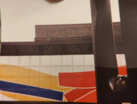 |
Detail of mural, canopy, and roofline. Taken a bit further north on Spruce Street from a school bus in 1991-1992. Taken by either the author or his brother Rob on an elementary school trip with 110 film. |
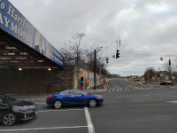 |
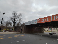
Looking up the entrance ramp to
the busway and I-84 at Asylum St/Spruce St (Exit 48A.) The bridge
with the Haymond sign on it is the unused HP&F/Highland division
bridge. In the distance, a white sign can be seen that says "Buses
Only." This is the entrance to the CTfastrak Bus Rapid Transit (BRT)
line that now occupies the HP&F right-of-way to New Britain
(12/2023.) |
 |
Looking south down the rail viaduct on the eastern side of Union Station into Bushnell Park. An Amtrak Metroliner (Budd, 1967-1970) cab car in Hartford Line service is just visible past the Hartford Healthcare sign (12/2023.) |
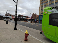 |
Northbound Hartford Union
Station CTFastrak stop, Asylum St. The Bus Rapid Transit system ends
just before Union Station, so Fastrak buses provide local service in
Downtown Hartford and make a stop nearby, but not inside, Union Station
(which has many bays for intercity bus service.) (12/2023.) |
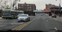 |
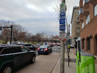
A northbound CTFastrak bus on Route 101 making a stop at Asylum St/Union Station (1/2024.) |
 |
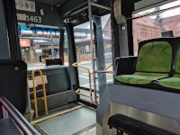
Southbound CT Fastrak bus stop on Asylum St, Hartford (12/2023.) |
 |
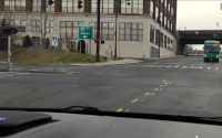
Riding a southbound (New Britain bound) CTFastrak bus past Union Station (12/2023.) |
 |
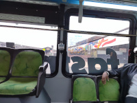
Fastrak busses enter the
HP&F right of way by making a left turn onto the Asylum St/Spruce
St entrance ramp to I-84 (Exit 48A.) Note the intercity Peter Pan bus
approaching on Asylum Ave, bound for Union Station (1/2024.) |
 |
Riding a southbound (New Britain bound) CTFastrak bus past Union Station (12/2023.) |
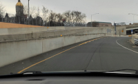 |
Looking up the Asylum St I-84 entrance ramp. Northbound CTFastrak buses coming off the HP&F right of way merge
just after the light pole at the end of the fence line and approach the
camera. The southbound entrance to the HP&F right of way is ahead
and marked "Buses Only" (1/2024.) |
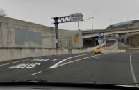 |
The southbound entrance to the CTFastrak Bus Rapid Transit section of the HP&F (1/2024.) |
| Next Section | Parkville |
Return to Hartford, Providence, and Fishkill Railway Index
(c) 2016-2024 Timothy M Dowd. Last Modified @ 22:50 EDT on 2024-07-01
Made with KompoZer v0.8b3 (20081229)