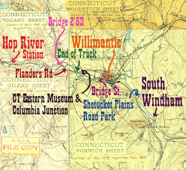
Willimantic has always been one of the most important sites along the Hartford, Providence, and Fishkill. Timetables from 1913 reflect this, as the New Haven Railroad issued separate documents for "Lines West of Willimantic and New London" and "Lines East of Willimantic and New London." Three major routes met along the low-lying right of way between downtown and the Willimantic River:
1.) The Central Vermont, today's New England Central RR. Still active from New London to the CN interchange at the Canadian border
2.) The Air Line, which from NY&NE days was united with the HP&F. In later years, the HP&F stations from Hartford still saw passenger service for Hartford-Boston bound trains that switched from HP&F to Air Line at Willimantic. This is abandoned in the Willimantic area and is railtrail both coming in from the southwest and leaving to the northeast.
3.) The HP&F. It enters the Willimantic area as it crosses the Shetucket as the active Providence and Worcester Willimantic Secondary. The New England Central (former Central Vermont) turns alongside it soon after it crosses and the two have several intergchanges from Shetucket Plains Road Park all the way to Bridge St, where they become a single track. After Bridge St the tracks divide again, some heading north to Canada as the New England Central, some stopping locally as the Connecticut Eastern Railroad Museum, and one continuing almost to the bridge at the Willimantic River, after which the rails are removed and the line is a railtrail all the way to Manchester.
Willimantic is a great place to see the HP&F in many of its current states. In particular, having a museum with an interesting vintage collection in the middle of an active railyard allows for some fun photography and allows the past and present to blend.
As always, these photos proceed as if you were heading west from Providence towards the Hudson
Click on the thumbnail for the full resolution image
| Previous Section |
South Windham |
 |
A
19th Century Seat Check, from the HP&F or one of its successors.
Note that it shows Willimantic as 58.5 miles from Providence, just as
the 1913 timetable that organizes this site does. |
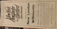 |
The cover of the October, 1913
NYNH&H timetable, showing that Willimantic was a dividing point for
the railroad between its eastern and western parts. Courtesy of James Mortimer. |
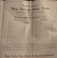 |
An advertsment for a new "Highland Express" train in the October, 1913 timetable seen above. This is Highland Express/Nutmeg service, and it lasted until Hurricane Diane destroyed an Air Line bridge in 1955.
Although at this time the New Haven Railroad was operating the entire
HP&F railroad, they were using different parts of it differently.
Waterbury to Willimantic service was connected to service north on the
Air Line connecting to Franklin and Boston. The two conductor's cash
fare tickets below show the HP&F stops between Waterbury and
Willimantic as listed with this service, and no other HP&F stops.
Courtesy of James Mortimer. |
 |
An early 20th century New Haven
Railroad conductor's cash form 32 ticket, sold between New York and New
Haven. It was not used on this line, but does list station stops
along it. The ticket is undated but was with a collection of similarly
weathered New Haven tickets with November 26, 1918 penciled on their
backs. |
 |
A
mid-20th century conductor's cash form 3 ticket, sold between New
Britain and Hartford and thus an artifact linked to this branch. It is
undated, but does not list Crescent Beach, Sound View, or South Lymeas
local stops along the Shore Line, so based on their dates of
abandonment on the Tyler City Station site, this suggests this ticket
is from the 1930s or later. Note that compared to the earlier form 32
ticket above, there are more local stops listed between Waterbury and
New Britain. This too suggests it was used for servce between Waterbury
and Boston, with a switch from the HP&F to the Air Line at
Willimantic. |
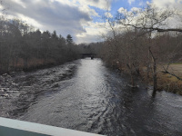 |
At South Windham, the Central
Vermont/New England Central railroad is running on the west bank of the
Shetucket, with the HP&F running on the east side. At Shetucket
Plains Road Park in Windham, the HP&F crosses the river to run
parallel and slightly below the other railroad. The map shows that it's
actually the HP&F that continues straight- the Central Vermont
actually joins the direction it has been going. The Shetucket river is
swollen in this picture because of recent extreme rain (1/2024.) |
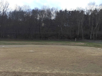 |
A view across a baseball field
at Shetucket Plains Road Park. The two railroads are visible on the
viaduct behind the field, with the HP&F in front and lower (1/2024.) |
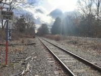 |
Looking back towards Plainfield
and the Shetucket River bridge. The near track is the HP&F- note
the "Begin track warrant control" sign here that matches the one at the
Railroad St. crossing in Plainfield (1/2024.) |
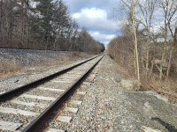 |
Looking towards Willimantic at
Shetucket Plains Rd Park. The difference in grade is obvious- the
HP&F is the closer track to the camera (1/2024.) |
 |
Approaching the Plains Rd bridge at Shetucket Plains Road Park. Note the telegraph pole (1/2024.) |
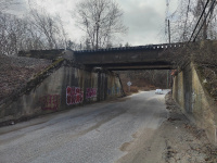 |
The twin rail bridges over
Plains Rd. The near bridge is still lower than the far one and carrys
the HP&F tracks that crossed the Shetucket (1/2024.) |
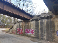 |
The twin rail bridges over
Plains Rd. The HP&F is on the left, the 28 mile marker is for the
New England Central towards New London (1/2024.) |
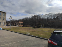 |
Looking southeast from Windham
Mills State Heritage Park across the Willimantic River. The river is
flowing east, and is one of the major tributaries of the Shetucket,
which we last saw in Shetucket Plains Road Park. Between here and there
the Natchaug River joins the Willimantic to form the Shetucket. The
railroad is on the far bank and on the near bank we see part of Willimantic Linen Company Mill № 2. (1/2024.) |
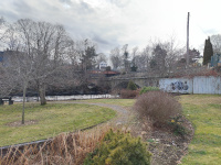 |
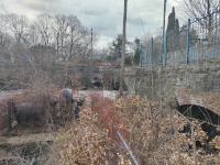
The former Windham Road Bridge, part of Willimantic Linen Company Mill № 1, now the Windham Garden on the Bridge.
A set of two train bridges is visible at the far end of the bridge.
They are still at slightly different grade, but between Shetucket
Plains Road Park and here they've had at least one interchange, behind Russ Road. (1/2024.) |
 |
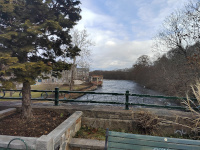
Another view of the former
Windham Road Bridge. The southern of the twin rail bridges is seen
spanning the former road and now pedestrian space (1/2024.) |
 |
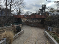
Looking East on the Willimantic
River from the former Windham Road Bridge. Willimantic Linen Company
Mill № 2 is on the north side of the river; the tracks are on the
south side (1/2024.) |
 |
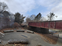
The northern of the two rail bridges above Windham Garden on the Bridge (1/2024.) |
 |
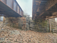
The southern of the two bridges over Windham Garden on the Bridge (1/2024.) |
 |
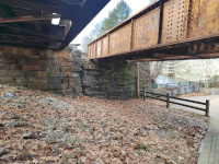
The two bridges over Windham Garden on the Bridge (1/2024.) |
 |
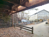
Looking out under the two bridges at Windham Linen Company Mill № 1. Today the building is known as ArtSpace (1/2024.) |
 |
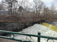
Looking out under the northern of the two bridges at Windham Linen Company Mill № 1. Today the building is known as ArtSpace (1/2024.) |
 |
Looking west along the
Willimantic River from the Windham Garden on the Bridge. We can see the
tracks are still on the south side of the river. They will cross over
to the north side and proceed to the downtown yard and station site on
a pair of trestles just west of the South Street Bridge (the one with
the frogs and thread bobbins on it.) Note how swollen the river was at
this time. (1/2024.) |
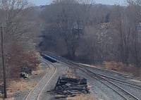 |
The trestles over the Willimantc River as seen from the Willimantic Pedestrian Bridge (1/2024.) |
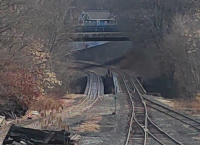 |
Another view of the trestles over the Willimantc River as seen from the Willimantic Pedestrian Bridge (1/2024.) |
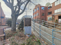 |
One of the best ways to see the
former station site at Willimantic is via the 1906 pedestrian
footbridge over the depot and yard area (1/2024.) |
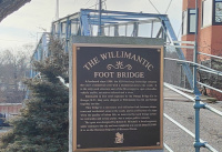 |
A close up of the plaque explaining the bridge's history (1/2024.) |
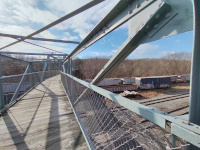 |
A representative view from on top of the Willimantic Foot Bridge (1/2024.) |
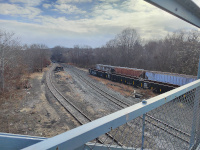 |
Looking back towards Providence
and the bridges across the Willimantic River from the footbridge. On
the southernmost track is a string of covered hoppers, one of which is
identifiable as TSBY 710066
owned by the Great Lakes Central RR (Tuscola and Saginaw Bay Railway)
and built 6/1980. On the adjacent track are Greenbriar Management
Services gondolas AOKX 42321, 42361, and 42309, all built in 8/2022. (1/2024.) |
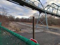 |
A similar view from track level, on a day when the yard was empty (1/2024.) |
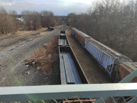 |
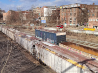
Another shot of the cars in the
eastward facing photo above. The gondolas seem to have steel billets,
wheras the covered hoppers have some sort of yellow, granular material
(1/2024.) |
 |
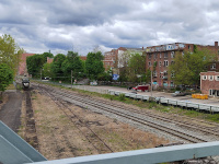
Looking northwest from the
Willimantic footbridge. The most notable thing is the large derelict
brick building at 760 Main Street,currently known as the Pouya building and in the hands of a developer who owns other Willimantic properties.
This building appears behind the historic depot in many photos, and is
a landmark for tying the past to the present. The depot would be
tracksde, between the yellow dumpster and the blue Iowa Northern Railway boxcar 8022,
which was built in 1/1979. Also visible are Great Lakes Central
Railroad (Tuscola and Saginaw Bay Railway Co) covered hoppers 710028
and 710036, the latter of which was built 5/1980, and Wisconsin Central Gondola 54037., which was built in 8/1995. (1/2024.) |
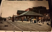 |
A c.1909 postcard showing the
depot. Compare the large brick building behind the depot (760 Main
Street) to its derelict 2024 version in the photo above. This postcard
was published by the H.C. Murray Co. of Willimantic, Conn and was their
№ 111. It was made in Germany and postmarked at Hop River on August 16, 1909. |
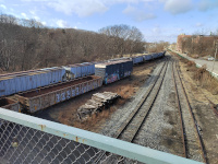 |
The other side of the cars in
the photo above the postcard. This shot is looking west towards Bridge St and
Hartford. It shows that although the wide yard remains at the depot
site (which once served 3 railroads heading in 6 directions) by Bridge
Street there is only a single track that crosses the street (1/2024.) |
 |
Providence and Worcester PW4069,
a GE C40-8 locomotive that was formerly Norfolk Southern NS8302, awaits
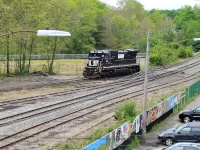
being brought into PW service. It had sat for more than six years at Larry's Truck and Electric in Lordstown, OH since being retired in March, 2017. The six axle locomotive was built in March, 1989 for Conrail as CR 6028 (5/2024.) |
 |
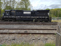
Another view of PW4069 (5/2024.) |
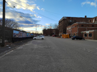 |
The site of the depot at track level (1/2024.) |
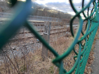 |
A vintage whistle sign, west of the depot (1/2024.) |
 |
A side view of PW4069, prior to
her being put into service. I tried to incorporate the whistle sign,
too. I find the patched Norfolk Southern livery somewhat charming,
almost like the locomotive is wearing a cummerbund (5/2024.) |
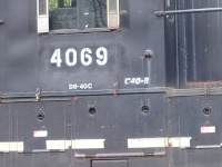 |
A closeup of the markings on the
cab of PW4069. Her prior number of NS8302 is just visible, and her
identification as a six axle (C) GE Dash-8 locomotive is duplicated
twice (5/2024.) |
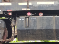 |
A closeup on PW4069's fuel tank confirms that it remains out of service (5/2024.) |
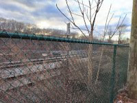 |
A modern mile marker, secured to
a vintage New Haven concrete post style marker. It reads 23, which is
the milage from Plainfield along the old HP&F. This photo is
looking west (1/2024.) |
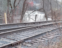 |
A nearby distance marker,
apparently made from an old rail, showing the milage along the New
England Central near the above HP&F mile marker. It appears to be
29 miles and some extra, which seems appropriate based on the 28 mile
marker we saw in Shetucket Plains Road Park. This photo is looking west
(1/2024.) |
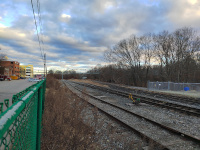 |
A look back east at the depot
site. It's obvious that the two extant railroads, the HP&F (P&W
Willimantic Secondary) and the New England Central, veer right (south)
at the end of the yard to cross the Willimantic River. The missing
railroad, the Air Line, would have continued straight for a bit and
then curved left (north) as can be seen in 1934 CT Aerial survey photograph 09089 (1/2024.) |
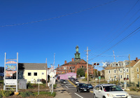 |
A look at the Bridge Street crossing, facing north towards the Windham Town Hall.
Note that it is only one track despite the size of the yards east (and
as we shall see, west) of the crossing. A sign directs visitors to the
Connecticut Eastern Railroad Musuem, which is a fair jaunt down the
tracks to the left. Immediately left of the road is a small concrete
platform that was briefly a stop on Amtrak's Montrealer in the early 1990s. (10/2023.) |
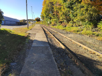 |
The former Amtrak platform, just west of Bridge Street (10/2023.) |
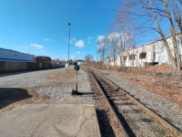 |
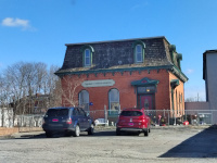
The very west end of the Amtrak
platform. Note that the yard is widening to multiple tracks again, and
the former freight office (with the mansard roof) (1/2024.) |
 |
The Willimantic Freight Office (1/2024.) |
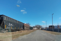 |
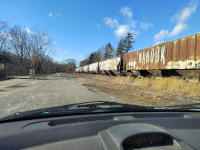
Looking back towards Bridge
Street, with both the Willimantic Freight Office and the Windham Town
Hall visible. 3 gondolas are present, all owned by Connecticut Waste
Processing. JAMX 1035 was built in 5/1981, JAMX 1112 was built in 8/1980, and JAMX 2024, the last one on the train, is very new, newer than 7/2022. (1/2024.) |
 |
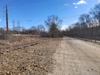
Looking west towards the Connecticut Eastern Railroad Museum. CSX Transportation covered hopper CSXT 252583 (built 4/1981) is in focus as part of a long string of covered hoppers. Its Seaboard Coast Line heritage is evident (1/2024.) |
 |
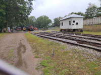
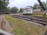
Looking back east towards Bridge
Street and Providence, with the string of hoppers nowhere to be seen.
It's a long drive down to the museum. Note that the revenue tracks (up
and left) and museum track (lower) are well separated here (1/2024.) |
 |
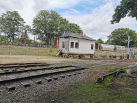
Looking west into the Connecticut Eastern Railroad Museum.
I love this shot for both showing this section of the Willimantic
railyards, but also some great museum pieces. From left to right, we
have the Versailles Operator's shanty, the M6 Metro North trainer cab, and the Columbia Junction Roundhouse. We then have on its own track Reading Railroad Osgood-Bradley Coach RDG 910 (1902). On the next track right, we have a small train consisting of New Haven Terminal 0413 (General Electric, 3/1943), Conrail Caboose 19882 (7/1944) (also here,) New Haven Osgood Bradley Coach 4414 (1907), and New Haven Osgood Bradley Baggage Car NH 3841 (1906). One track over is GE 44 Ton Locomotive 0800 (12/1950). In the foreground is the operator's shack from the former Niantic River (NAN) Bridge.
On the revenue tracks outside a long train of gondolas is parked,
including (just out of shot, but included in the shot below) Coastal Distribution CDEX 16235 (4/2016.) (9/2023.) |
 |
A
similar shot to above, but a bit more right so that Coastal CDEX 16235
is visible. I love shots from this museum because of the opportuntity
to get modern and vintage equipment in the same shot (9/2023.) |
 |
A look back east towards the
musuem gate from inside. We see at least two revenue tracks just
outside the museum fence, and the far track, the NECR main, is occupied
by a train containing a bulkhead flatcar JTSX 900054 (built 6/1991 Joseph Transportation,) covered hopper NAHX 503645 (owned by General Electric Rail Services,) and covered hopper AEX 21412, owned by Anderson's. In the foreground is the former operator's cabin from the Niantic River (NAN) bridge (6/2022.) |
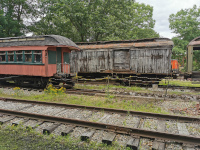 |
Two of the CERM's Osgood Bradley holdings, Reading RDG 910 (1902) and New Haven Baggage car NH 3841 (1906.)
One of the hoods of GE 44 ton locomotive 0800 is peaking out from
behind the baggage car, and outside the museum on the revenue tracks we
can see a train of centerbeam flat cars(6/2022.) |
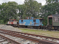 |
This is the front of the small
train seen in the photo from the gate. At left is New Haven Terminal
0413 (3/1943) and in the middle is Conrail caboose 19882 (7/1944.) At
right is the front of New Haven Osgood Bradley coach 4414 (1907.) The plan is for the Conrail caboose to be restored to its New Haven glory days, but I do kind of like it in Conrail blue (6/2022.) |
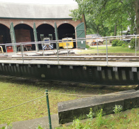 |
Columbia Junction Roundhouse. Also visible is the turntable, as well as the noses of the Central Vermont Boxcar 43022 (1929), the Northeast Utilities 25 Ton Locomotive (1958), and the Maine Central Railbus (6/2022.) |
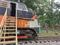 |
In the foreground, Connecticut Department of Transportation EMD FL9 (11/1960). In the background on the revenue tracks, Canadian National Centerbeam Flat car 626310 (11/2004) (our best guess from blurry photos.) (6/2022.) |
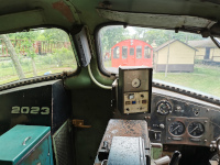 |
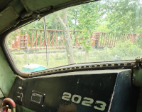
Cab view from FL9 2023 looking
back east towards Bridge St and Providence. Prominently visible are the
train of centerbeam flatcars, as well as Central Vermont Alco S-4 8081 (9/1955). (6/2022.) |
 |
A
last look at the train of centerbeam flatcars, CN 626310 (11/2004)
appears to be visibile out the cab window of the FL9 (11/1960.) |
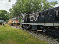 |
Looking west towards Hartford, we see Central Vermont S-4 8081, CDOT FL9 2023, and New Haven 8600 Series Coach NH 8673 (PC/MBTA/Cape Cod 2569) (1947-1948). (6/2022.) |
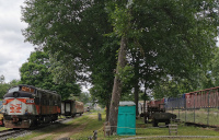 |
A
nice shot of New Haven RR survivors: NH FL9 2057 (CDOT 2023) in the
foreground, with NH 8673 (PC/MBTA/Cape Cod 2569) coach behind and in
the far distance, NH Coach 8695 (PC/MBTA/Cape Cod 2591.)
Also note the vintage 1937 American Bridge Co bridge in the distance
past NH 8695- the remaining HP&F track towards Hartford goes under
that bridge, but the New England Central Mainline, here with our train
of centerbeam flatcars on it will not- it veers north to cross under
Route 66 closer to the camera. (6/2022.) |
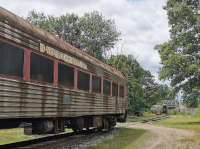 |
A
final shot from inside the museum yard, this gives a detailed view of
NH 8673 and a distant view of NH 8695, as well as the 1937 Route 66
bridge. Also just visible is SPV-2000 Metro North 293 (11/1981). (6/2022.) |
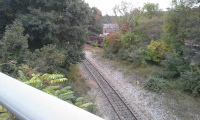 |
Although the museum tracks are
laid along the right of way to Hartford along the old HP&F, the
rump remaining track that is still used as a siding in revenue service
isn't connected to the yard track, it diverges from the New England
Central main just before that railroad curves north to head under Route
66 in its own underpass. This photo does a decent job showing this. In
the woods at far right, we can see one of the NH 8600 series coaches on
the museum tracks. The gondola in the foreground has been switched onto
the HP&F tracks towards Hartford at the last interchange with the
New England Central, just behind the trees to the left. The railroad
running towards the camera is the New England Central and this shot is
taken from the overpass over it. We are looking back towards
Willimantic (10/2016.) |
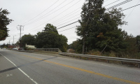 |
A photo of where I took the
previous shot from, looking still towards Willimantic along the New
England Central. This overpass has since been updated (10/2016.) The next few photos are going to be along the New England Central and not the HP&F. There are two reasons for this 1.) The Willimantic Secondary being open today relies on being able to interchange with the New England Central here. So seeing where it goes next and some of the locomotive power it has is tangentially relevant 2.) One of the photos will help orient us to see where the HP&F goes next |
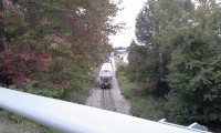 |
Looking north towards Storrs and
Canada along the New England Central. Note there are two locomotives
and a covered hopper (10/2016.) |
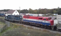 |
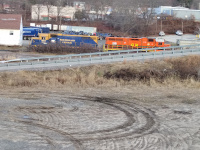
This shot was taken of the two
locomotives from Recycling Way, the road to the recycling plant that
intersects Route 66 between the HP&F and New England Central
overpasses. NECR 437 is an EMD GP40-2 built in 10/1979. NECR 3039 is also a GP40-2, built in 6/1974,
but the GP402-LW variant made for Canadian National. The shot does a
good job showing the difference between the standard cab on NECR 437
and the Canadian comfort cab on the 3039. (10/2016) |
 |
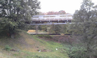
Eight years later, New England Central GP38AC 3851 (built 4/1971) and Buffalo & Pittsburgh GP38-2 3511 (1/1972)
are in the same spot with a train of covered hoppers. The 2016 shot was
taken from Recyling Way, the road in the foreground. This is taken from
Route 66, which shows a small vacant space between Recycling Way and
the highway. The next shot will be taken from this space, directed
under the 1937 overpass over the HP&F (1/2024.) |
 |
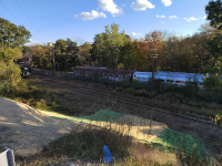
This shot is taken from the
vacant lot in the above photo. The 1937 American Bridge Company bridge
carries Route 66 over the HP&F. Note the very distinctive telegraph
pole- this is along the HP&F right of way and we'll see it in
future photos (10/2016.) Now we go back to looking at the HP&F right of way from up close. |
 |
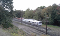
Looking south and east from
Route 66, a bit futher west than last the last time we looked in
this direction to where the HP&F left as a spur from the New
England Central, we can see the roundhouse, a black gondola parked on
what passes for the HP&F mainline at this point, and NH 8695 and
Metro North 293 parked at the end of the museum track (10/2023.) |
 |
Looking south and east from
Route 66. This photo shows the end of the museum trackage, and a decent
view of Metro North 293 and NH 8695. The track outside the museum yard
follows the HP&F right of way under the Route 66 bridge and almost
as far as the Willimantic River.(10/2016) |
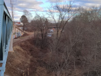 |
Looking back east from the Route
66 road bridge. From background to foreground, we can see the train of
covered hoppers and gondolas that NECR 3851 and BPRR 3511 are pulling
along the New England Central (see photo above,) and how far away its overpass is from
the HP&F's (see above for the front of that train.) We then see the
empty HP&F mainline passing under this 1937 American Bridge Company
bridge. We see the Metro North 293 and New Haven 8695 in their usual
place at the end of the museum track. Finally, we see the distinctive
telegraph pole that we could see under the overpass from the New
England Central yard (1/2024.) |
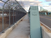 |
The historic road bridge and its builder's plaque (1/2024.) |
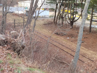 |
The
HP&F mainline west of Route 66. Despite it being in a heavily
industrial area, this little stretch seems almost bucolic, like the
Valley Ralroad in Higganum. Google Earth photos shows that these tracks
have been in use relatively recently, though (1/2024.) |
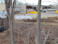 |
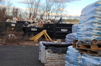
One final siding. The mainline continues into the waste processing center behind Mackey's Home, Farm and Pet Supply (1/2024.) |
 |
In the junkyard behind Mackey's:
the western end of active rail service on the HP&F for many miles.
According to Google Maps, this is about 1.5-1.7miles west of the
original Willimantic Depot, making this about 60 miles west from
Providence and 24.5 miles west from Plainfield. Officially, the
railroad is abanoned from this point west to North Main Street in
Manchester (milepost 81 from Providence, about 21 miles west of here.)
No train has run east of Burnside (milepost 86, 26 miles west of here)
since 2017, according to information on the Connecticut Southern
Railroad Facebook page (1/2024.) |
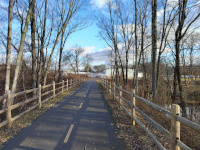 |
The beginning of the Hop River
Trail's residency on the HP&F mainline. This very new paved section
of the Hop River Trail is reminiscent of the Washington Secondary
between Cranston and Summit. We are looking east towards Providence:
the junkyard behind Mackey's is visible, as is in the distance the 1937
American Bridge co bridge carrying Route 66 above the HP&F. The
HP&F goes straight to that bridge, but obviously the Hop River
trail curves to a parking area at Mackey's and also a junction with the
Air Line trail. (1/2024.) |
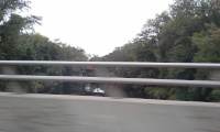 |
This 2016 photo, shot from a
moving car crossing the Route 66 bridge over the Willimantic River,
shows the train bridge before being rehabbed and refitted into the
current trail bridge. According to Jack Dougherty, a biking blogger and fan of the East Coast Greenway, the bridge was opened to the public in October, 2019. (10/2016.) |
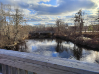 |
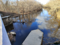
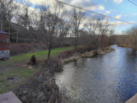
Looking south down the Willimantic River from the train bridge back to the car bridge in the above photo (1/2024.) |
 |
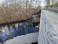
Looking north up the Willimantic River from the train bridge (1/2024.) |
 |
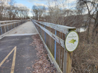
Looking east towards Providence on the train bridge (1/2024.) |
 |
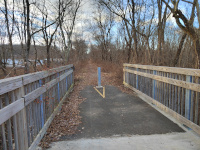
Looking east from the west bank of the Willimantic.
One thing that makes the geography hard to understand around here is
that Willimantic hasn't existed as an independent city since 1983, when it merged back into the surrounding Windham. So we have been looking at photos in Windham since the site of the South Windham depot. We
are currently standing in Columbia, looking back at Windham. In
addition to this confusion, the Hop River is the border between
Columbia and Coventry to the north, so we'll only briefly be in
Columbia (from here to the derelict Bridge 2.53) before entering our
second Coventry along the HP&F, Coventry, Connecticut. Jack
Dougherty's biking blog has a good map describing this. (1/2024.) |
 |
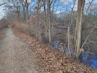
Looking west towards Manchester and Hartford at the end of the Willamantic River bridge (1/2024.) |
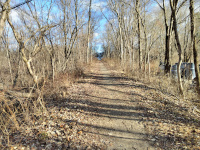 |
Looking back east towards
Willimantic and Providence. The straightness of the right of way is
very clear here- we're still pointing right at the 1937 American Bridge
Co. bridge of Route 66 over the railroad. You can see it when you zoom
in (1/2024.) |
 |
Looking east towards Manchester and Hartford (1/2024.) |
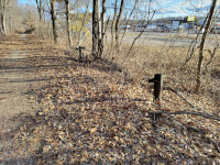 |
A seemingly intact spare rail holder.
This is one of three I know of along the HP&F; there's one holding
rails, with a sign explaining it, in Vernon. We found a partial one, along the active Willimantic Secondary, at the depot site in Baltic. My father, Bernard
Dowd, who found the Baltic one after I overlooked it, remembers that
these were common around the New Haven system (1/2024.) |
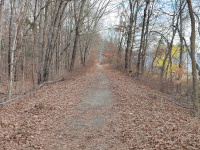 |
Another
look back east at the railholder. Amazingly, the right of way is still
so straight that the 1937 Route 66 Bridge is still visible (1/2024.) |
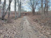 |
Looking west towards Manchester
and Hartford. In the foreground, there is a small cement structure,
presumably used to hold a sign, signal, or crossing equipment once.
Ahead there is a modern cement culvert through a viaduct carying
Flanders Road. This culvert doesn't have much of a past (it was put in
when the road was rebuilt) or a future (the plan is to replace it when the trail is reopened to the public)(1/2024.) |
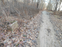 |
The cement structure in detail (1/2024) |
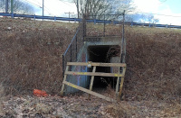 |
The culvert in detail. Note that
access is prohibited and that the trail beyond is posted closed to the
public. This is because of the derelict condition of Bridge 2.53 (1/2024.) |
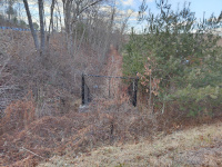 |
On top of the culvert on
Flanders Road, looking west towards Hartford. Note that this section of
the trail is posted closed to the public (1/2024.) |
 |
One last look from Flanders Road
at the HP&F roadbed, which is running elevated and parallel to the
Hop River as it emerges from behind the barn in this photo. There's
about ⅓ of a mile between this shot and the derelict Bridge 2.3 over the Hop River, where the next section begins (1/2024.) |
| Next Section |
Hop River |
Return to Hartford, Providence, and Fishkill Railway Index
(c) 2016-2024 Timothy M Dowd. Last Modified @ 12:57 EDT on 2024-05-18
Made with KompoZer v0.8b3 (20081229)